O Canada

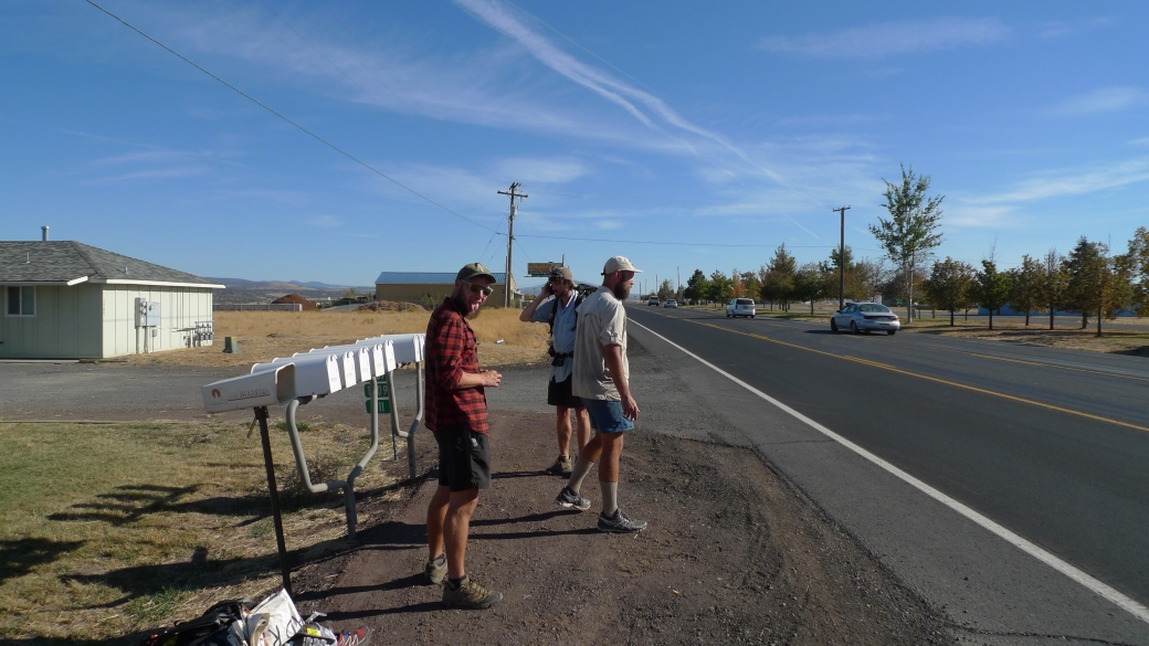
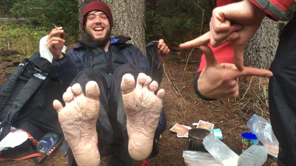
After having decided to quit the trail for good, and finding the closest random road on my maps to try to head home from, I found myself walking down said road, hoping that it would lead to some civilisation. I walked for a mile or two towards some buildings I could see in the distance, sticking my thumb out to a couple of hunters driving by who just ignored me. I made it to the buildings, which turned out to be a forest service building that was closed, and looked around for someone to ask for some directions or a ride. There were houses and other buildings around, but no sign of any people.

Feeling lost and ever so slightly desperate, I stuck my thumb out for a lone car driving past. It was two ladies holding a bag outside their window, who acknowledged me, but drove round the corner, presumably to get rid of whatever was in that bag that was too smelly to keep it inside the car! They drove back round, and asked me what I was doing wandering round the road looking dischevelled and lost. I asked them if they could take me to the nearest town that had some food and a bed to sleep in. They looked at me, looked at eachother, asked if I was a serial killer, and offered for me to stay in their cabin that night, just around the corner.

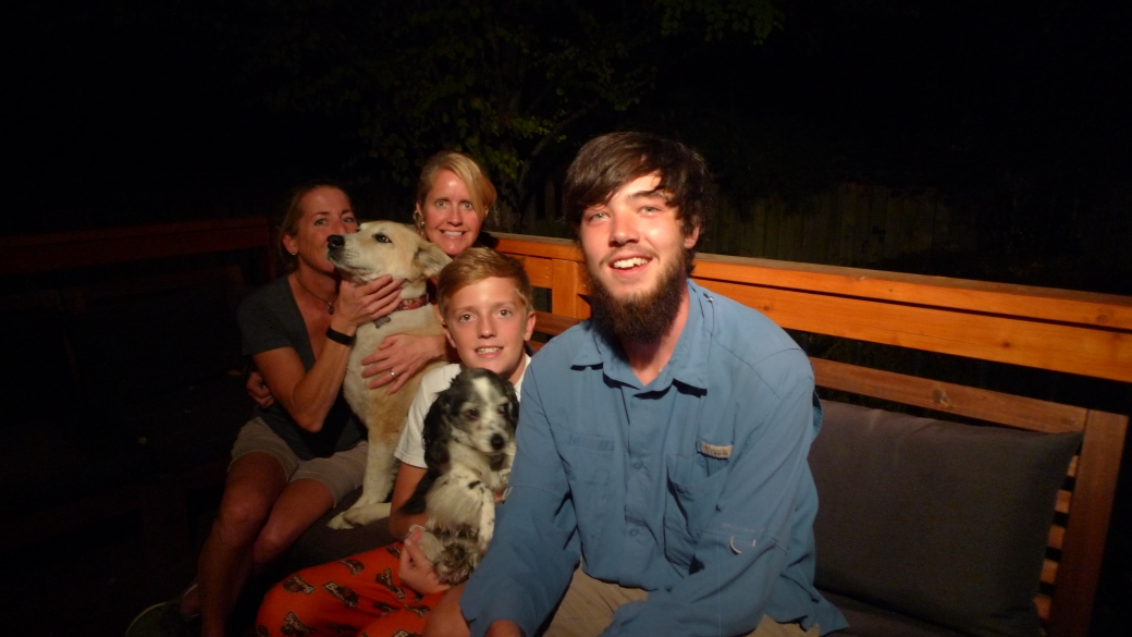
This couple, Chantal and Susan, turned out to be some of the most generous, and caring people I met on the trail. They brought me back to their cabin, (not before asking if I was a serial killer a few more times) fed me a delicious home-made hot meal, with beer, did my laundry, let me shower, and we exchanged stories. I could not have wished for more. It was a much-needed relax, and gave me time to assess my situation. They then told me how they have a house in Portland, and I was welcome to stay with them there, as it would be a convenient place to travel back to England from, should I decide to. I humbly accepted, and the next morning we headed for the city.

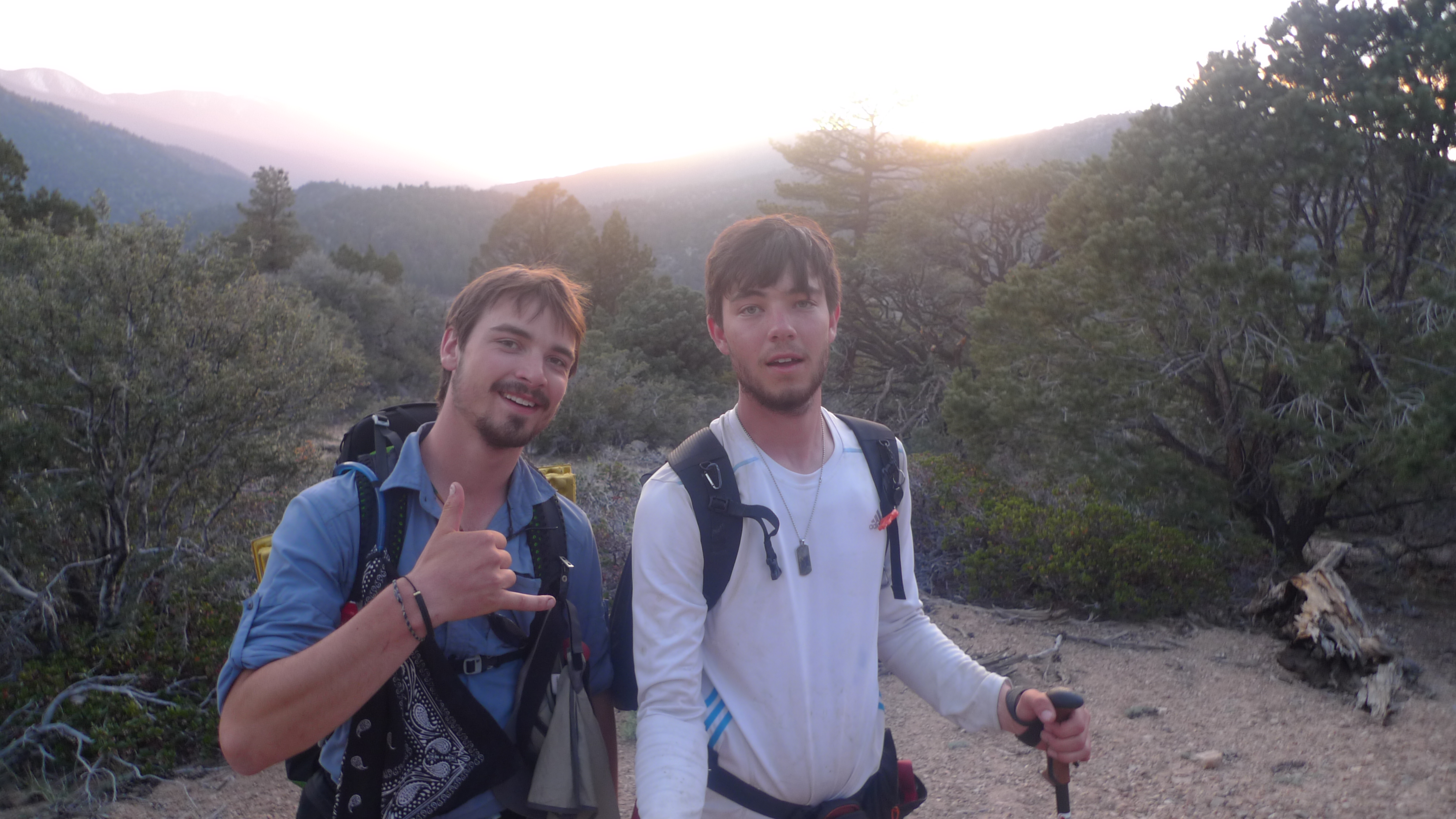
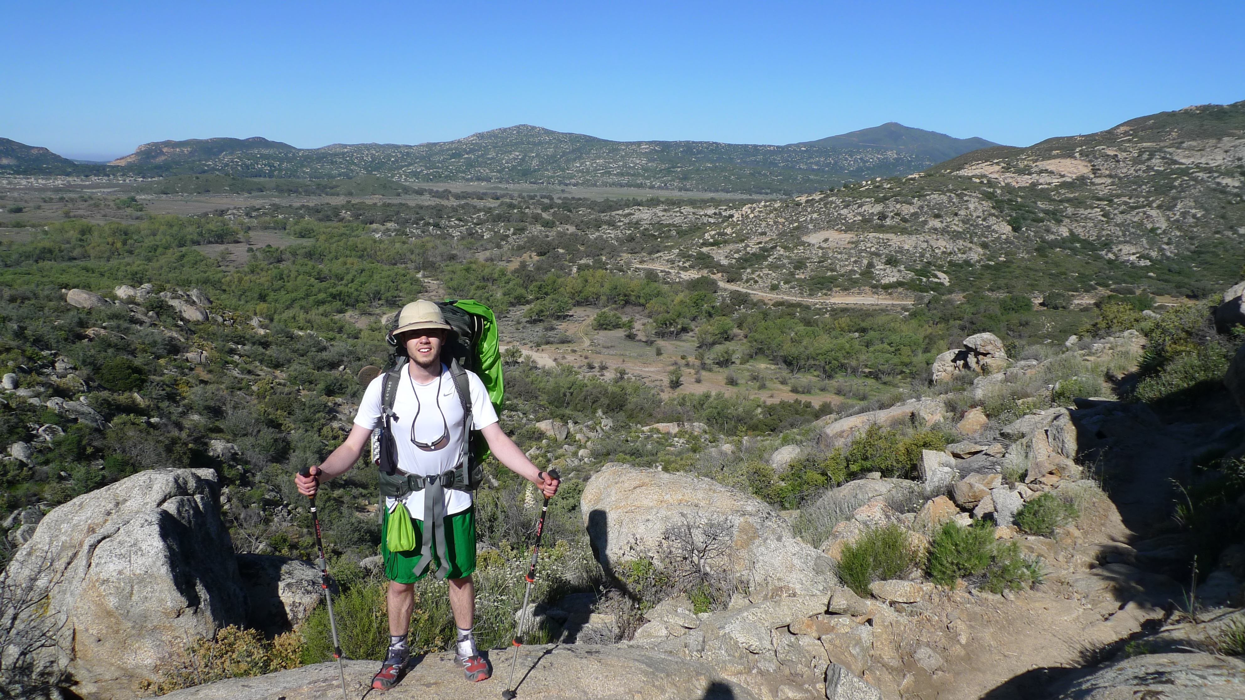
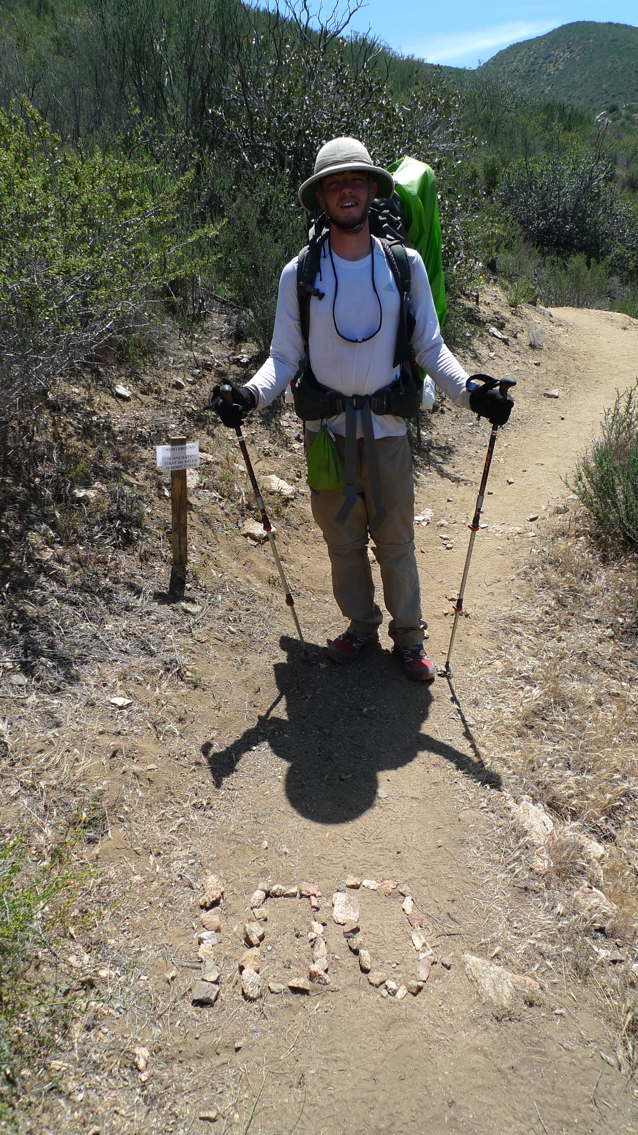
Still unconvinced of my decision to quit the trail at that point, I happened to receive a call from Sledd-Dogg, who was hiking with Dupont and Llama, a little ahead of me on the trail at a place called White’s Pass. After a brief chat, Sledd suggested that I head up where they were, and hike the rest of the trail with them. In contrast to my misery the day before, the thought of meeting up with old hiker friends and finishing the trail with them was instantly uplifting. Feeling like this would have been a premature end to my adventure, it seemed like a perfect plan. I worked out it would take me longer to get to White’s Pass than they would be there for, and not wanting to play any more catch-up, I decided to take my time and meet them at their next stop- Snoqualmie Pass.

The next few days, I spent getting spoiled by Chantal and Susan. They introduced me to their lovely son Parker, took me out to meals, and introduced me to some of the Portland gay-scene. It was quite the experience. One evening I impressed them with my excellent salsa recipe, and we swapped some other cooking tips. It was eventually time to head up towards Seattle, where I could get to Snoqualmie. I was planning on hitching, or getting a cheap coach, but Susan and Chantal insisted that I took the scenic train ride and so bought me a ticket to Seattle, along the Puget Sound. It seemed there was no end to their generocity.

P1020261

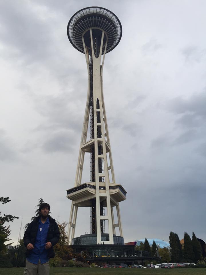
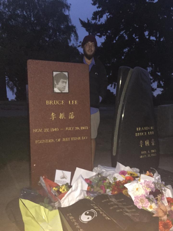
The train was absolutely worth it, the last part of the journey we were going right up along the Sound, with views of Olympia National Park. There was a nice Austrailian chap on the train called Mim, who was also in Seattle for only a day, so we grabbed a beer together at a local Brewery straight off the train. We ended up meeting up again after he checked into his hotel, and went round seeing the sights together- Pike’s Place Market, the Space Needle, Bruce Lee’s grave, and a few others. There is an alleyway downtown in Seattle, where it seems it is a tradition for people to put their chewed chewing gum on the wall, a place called Gum-Alley. I know thru-hikers arent exactly well known for their hygiene, but this place seemed disgusting to me. I wondered how many strains of herpes were lurking around that alley.

Space Needle

Bruce lee's Grave

Walking around Seattle, looking like a homeless person was an interesting experience. For months, I wore my homeless look like a badge of honour- people would recognise me as a PCT hiker and treat me like a celebrity. In the city, it was different. I just became another nobody, another down and out. For a day I got to see what it was like to be an urban homeless person. People gave me dirty looks or avoided eye contact all together and shielded their pockets as I walked by. I remember approaching one gentleman for directions, but before I had finished saying “excuse me”, he was patting his pockets and shrugging in a gesture saying “I dont have any money for you”.  I proceeded to ask for directions with a smile on my face, and after hearing my accent, I think he was slightly embarrassed. Although he couldnt help me, he got out his phone and was trying to find out the way I needed to go, in what felt like overcompensation for his mistake.

Some family friends had offered me to stay at their house on Bainbridge Island for a couple of days whilst I waited for Sledd, Dupont and Llama to arrive at Snoqualmie. The day before I was anticipating the guys to arrive, I headed off towards the trailhead. The bus system in Seattle only took me as far as a place called North Bend, from where I planned on hitching. It was an exhausting bus ride, where I met the loudest girl I have ever encountered- she literally would not stop talking, saying every little thing that came to her mind for about an hour straight at the top of her voice. Friendly, but seemingly insane. Everyone else on the bus seemed like they knew eachother, as if they all take the same bus every day, so although annoyed by the cacophony, they seemed used to it.

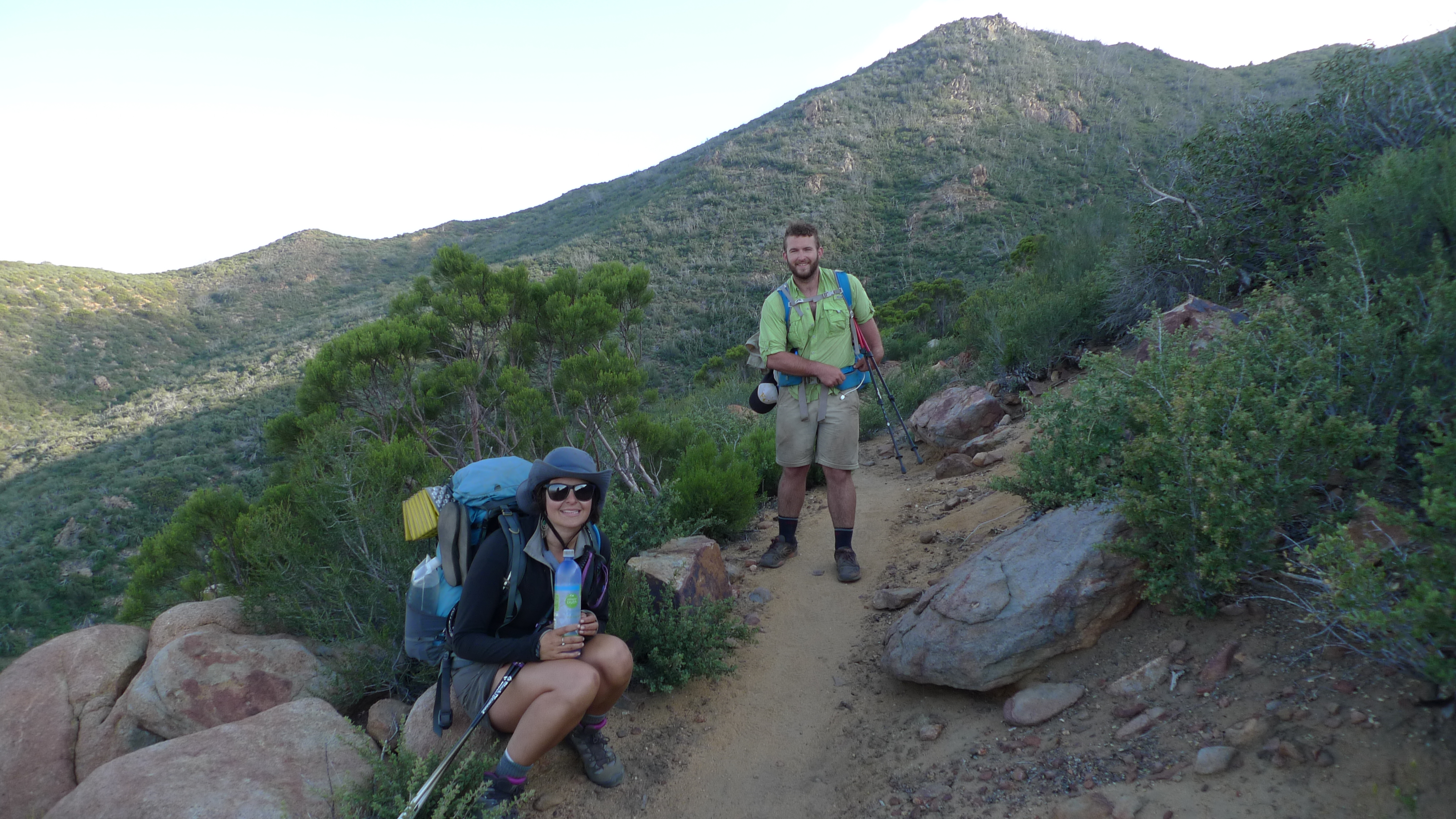
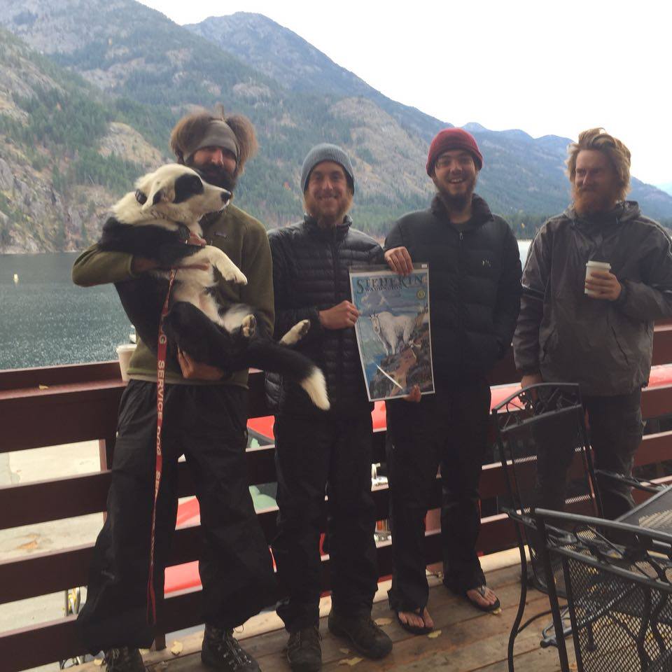
Unfortunately, North Bend did not turn out to be the quaint, friendly little town I was hoping for. I arrived just after dark, and for the first time, I didnt feel like stealth-camping was a viable option. The place was full of shady looking characters and tweakers (a word I learned that refers to somebody who takes crystal meth), so I decided getting a hotel room for the night was the best option. The next morning, I stocked up on burgers from the McDonalds dollar menu to bring to my friends when they got off trail, and stuck my thumb out again to get to Snoqualmie. The weather was getting really bad, but I stood under an underpass for over an hour before somebody gave me a ride. When the others finally did arrive in Snoqualmie, I greeted them with a bag full of dollar-menu burgers, some candy and a bottle of whiskey. Since the weather was terrible, and they arrived after dark, we stayed in the lodge there that night, as there was nowhere to really camp either. The rain only got worse the next day, coming down in buckets, so we studied the weather forecast, and decided it was best to leave the day after.

Snoqualmie Hot tub

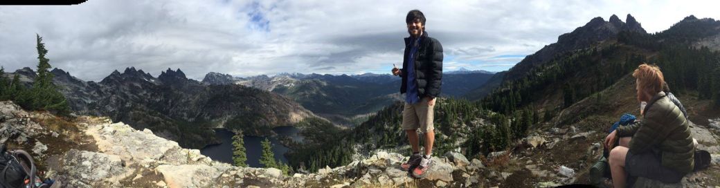
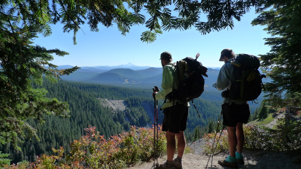
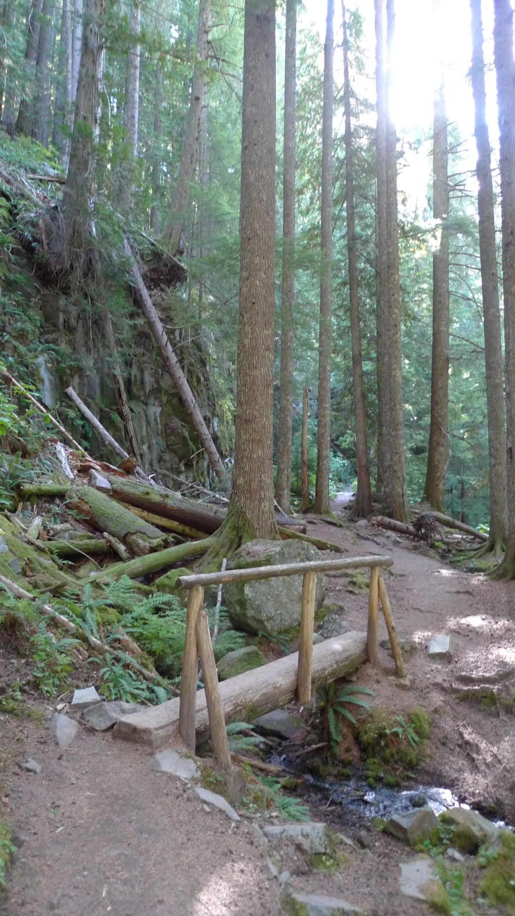
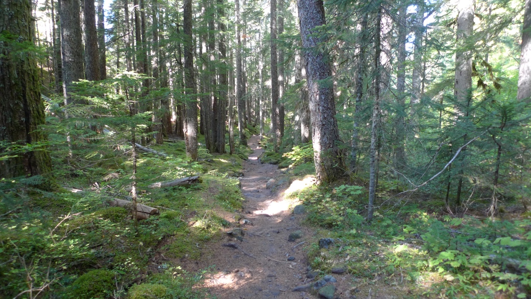
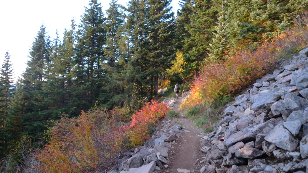
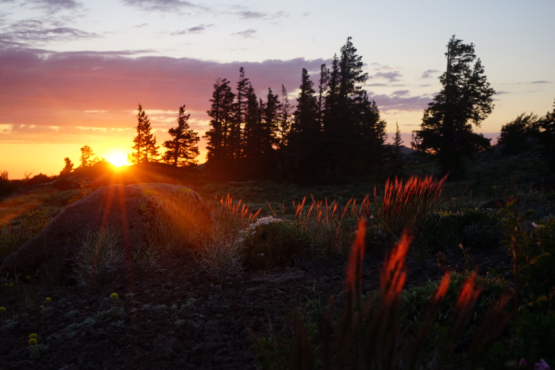
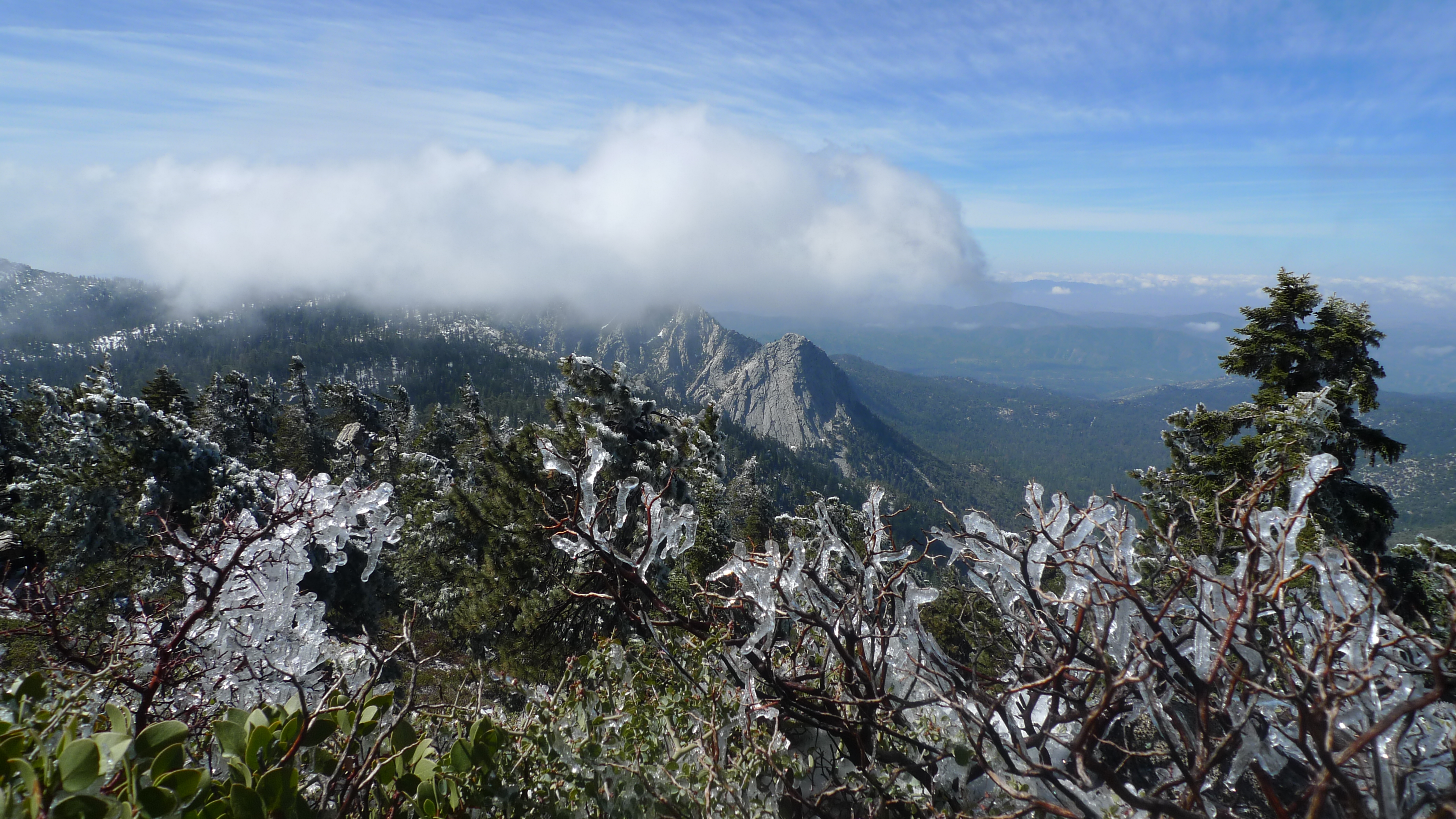
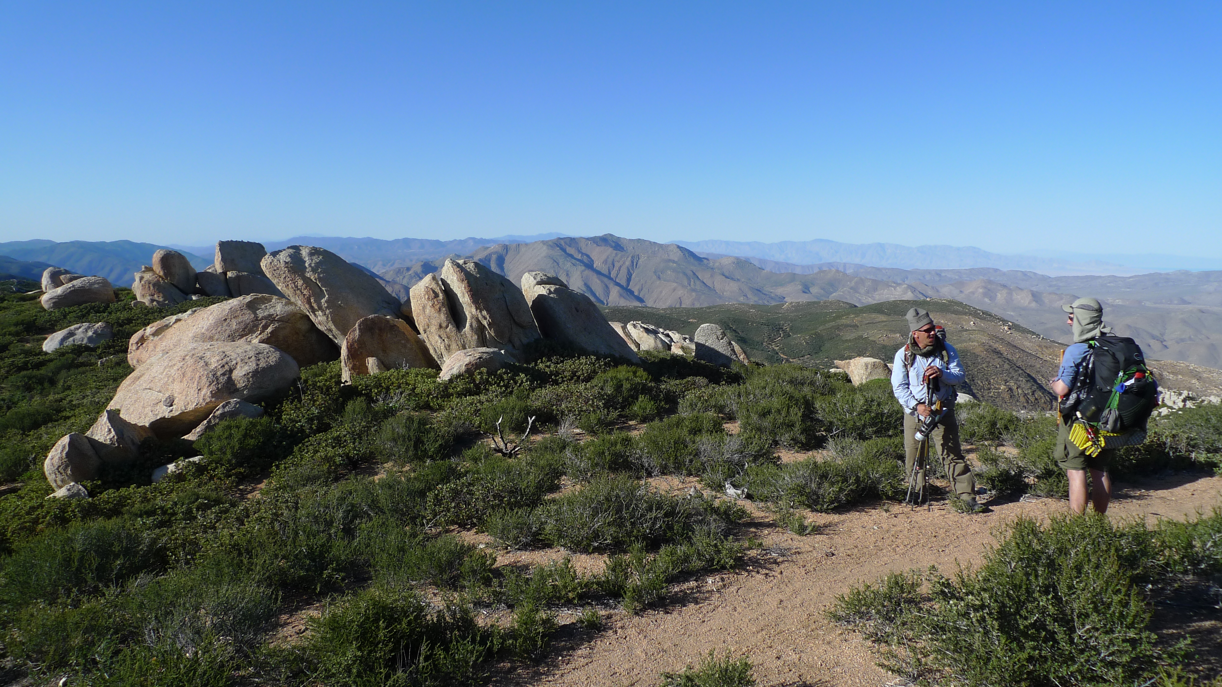
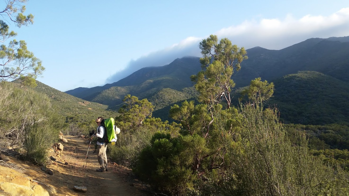
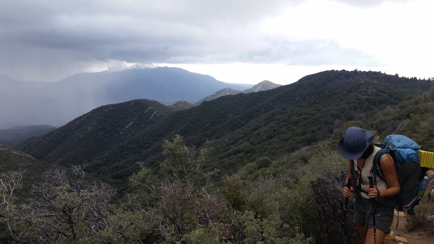
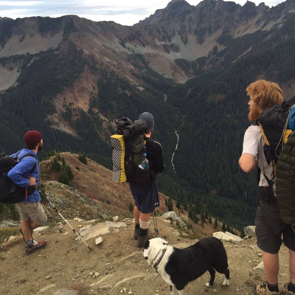
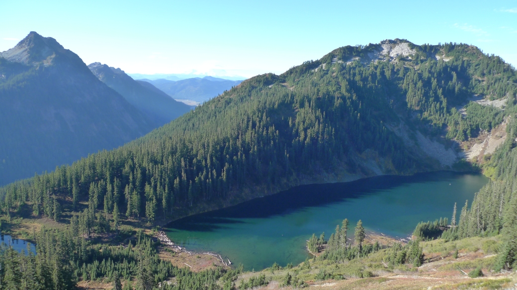
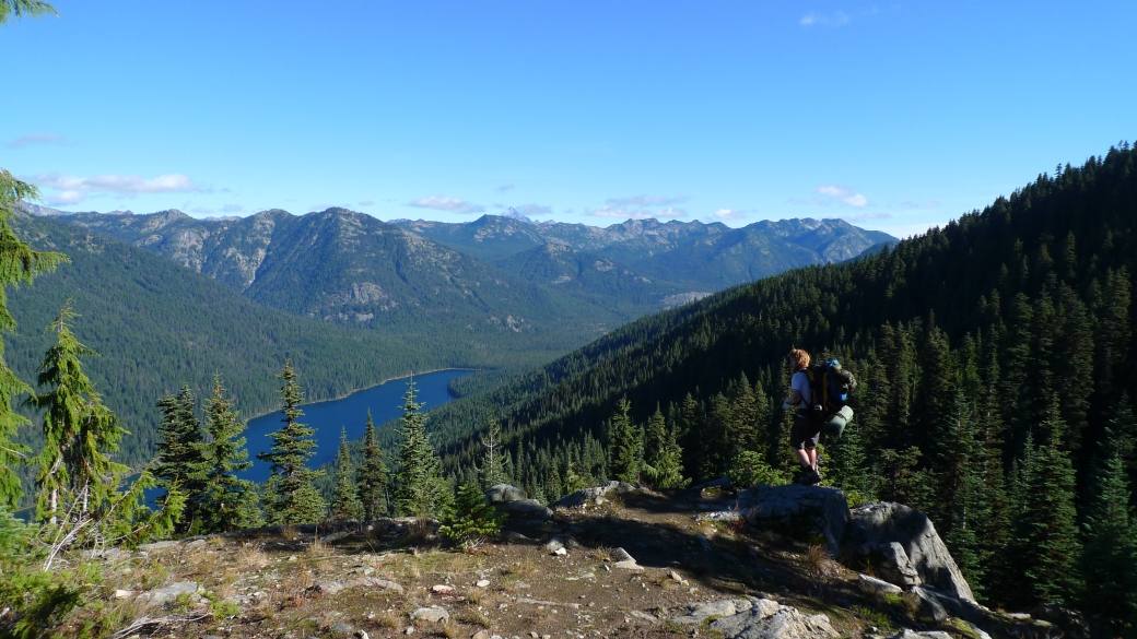
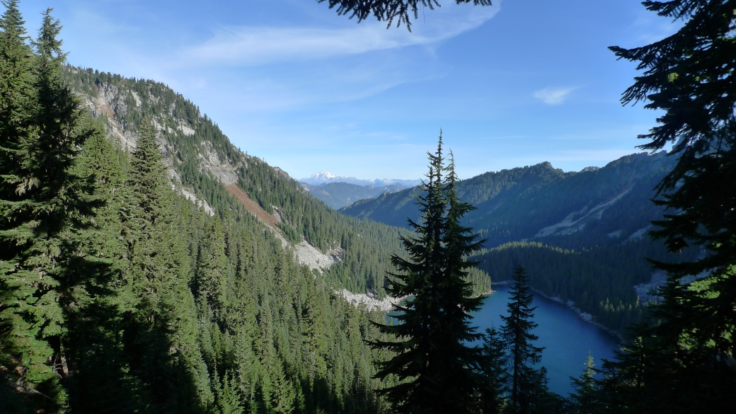
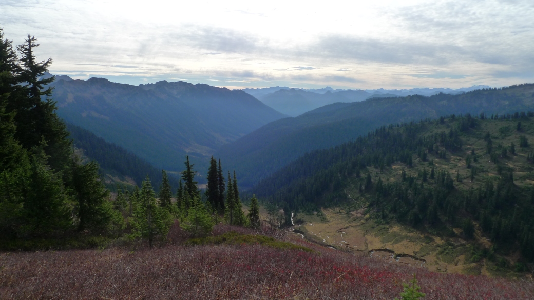
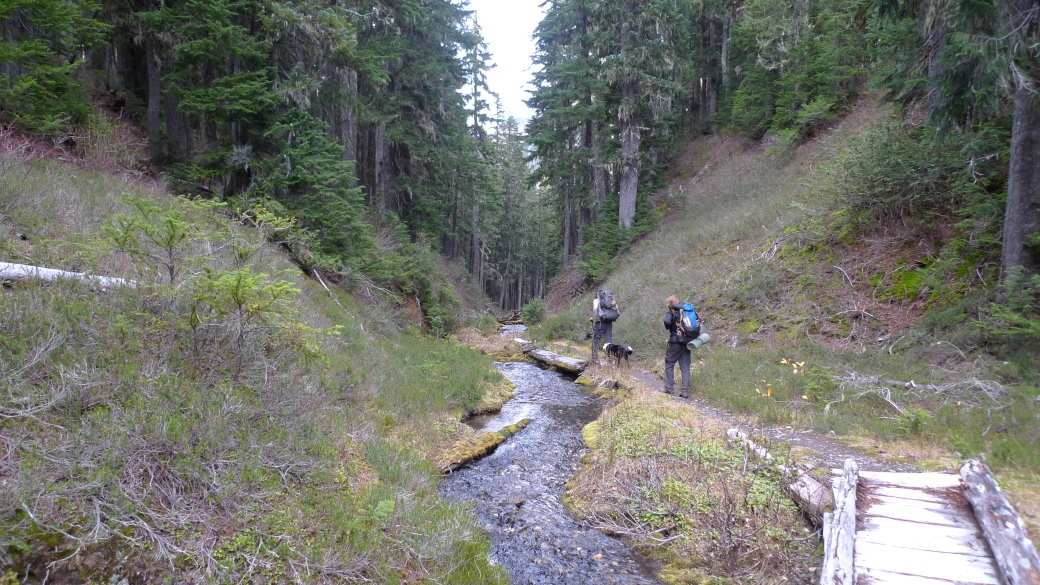
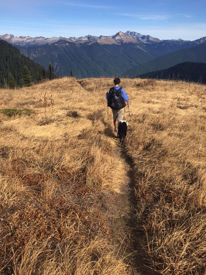
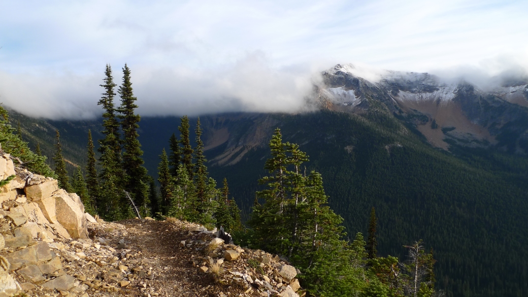
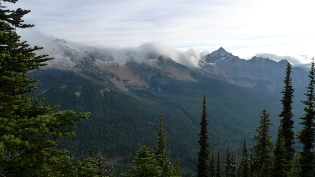
Some people say that some years you can hike the whole PCT and get rained on only a handful of times. This was definitely not one of those years. When we finally did get back on trail, it was still raining a little bit, but it felt great to be back with friends, and back on the trail again after quite a bit of time off. For the first time, I was hiking in Washington and was actually able to see how gorgeous it is.

Us in WA

P1020269

P1020266

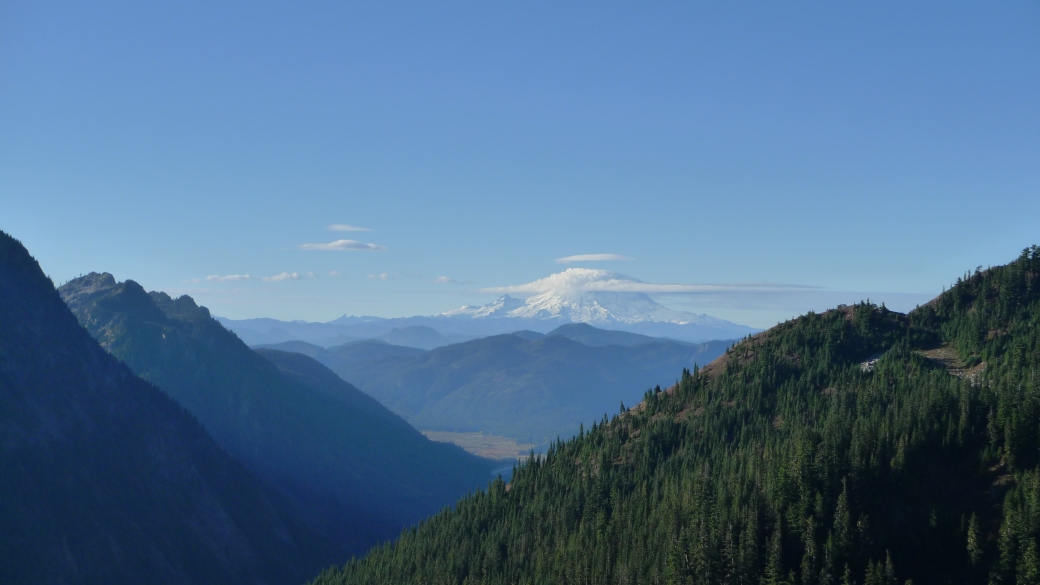
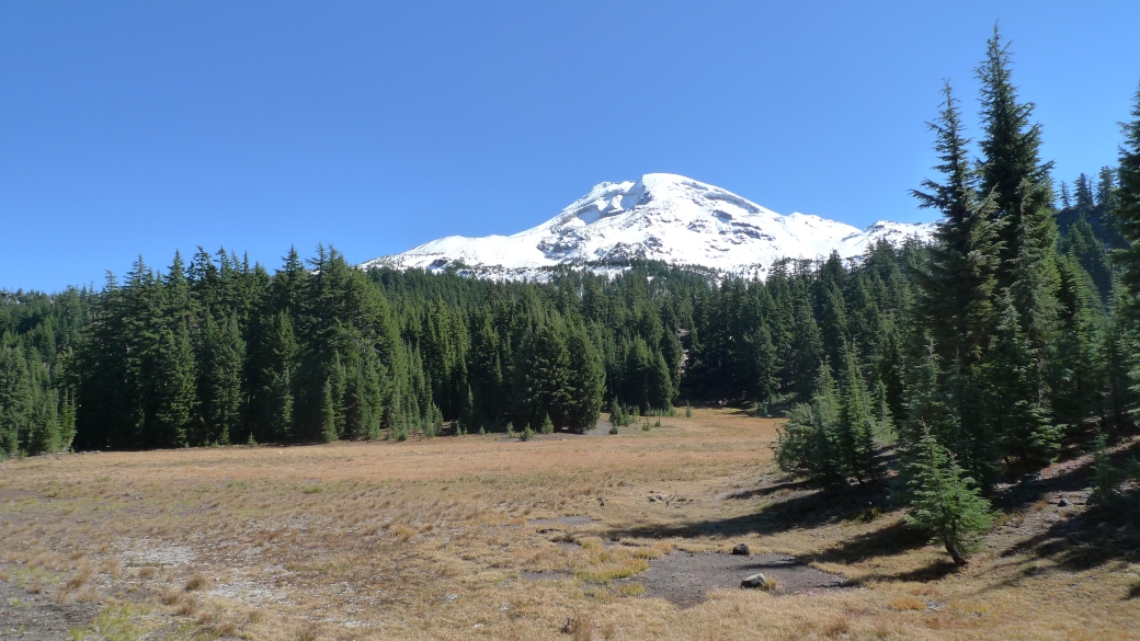
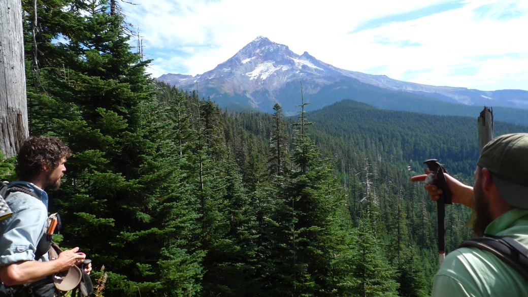
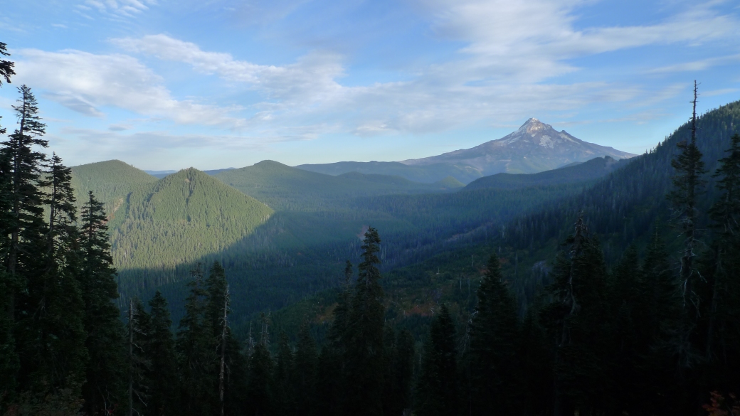
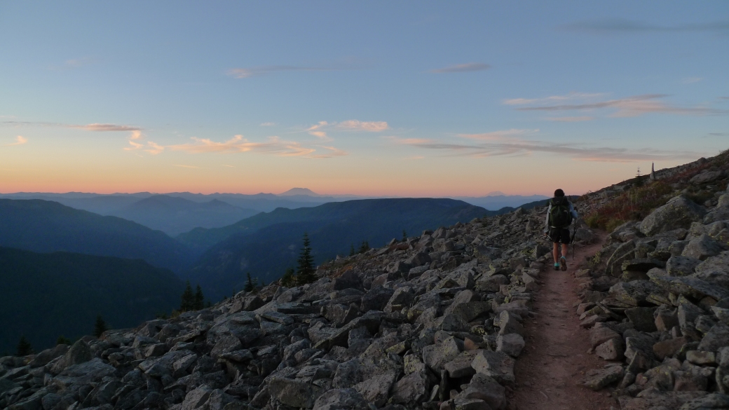
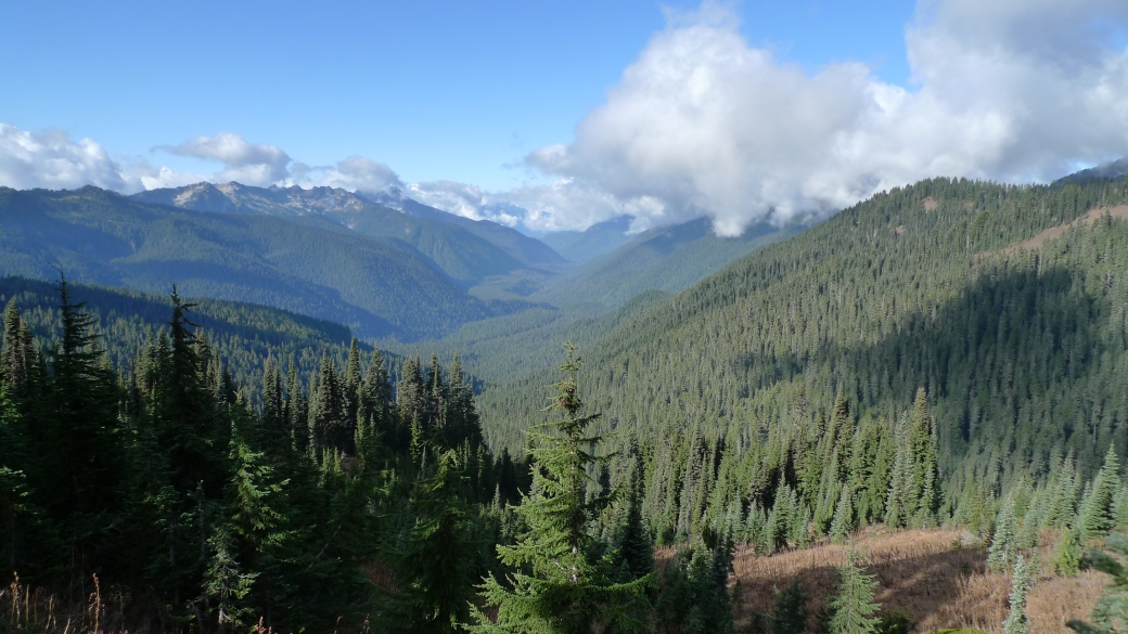
The magnificent Mt Rainier in the distance

The next day, I went the wrong way on trail for the first time. Occasionally if there is a junction, someone will have placed a stick over the wrong way, and sometimes leave an arrow pointing the way the PCT goes. I was hiking in the front with Llama and Sledd just behind me, with Dupont a little further back, out of sight. We came up to a fork, and like many, many times before, somebody had left a stick over one of the paths, and an arrow pointing down the other. There was a wooden sign with more information on it, but I took no notice and followed the arrow down the right fork. Llama and Sledd did the same.

After about a mile and a half, we hit a little river that we couldn’t cross without wading through a couple of feet of water- a little unusual for the trail, so checking the GPS, it turned out we had taken the wrong turn. The arrow had lied! We walked back to the junction, pissed off at having to walk an extra 3 miles, but there was no sign of Dupont. He must have done the sensible thing and read the actual sign, which told us that the PCT went to the left. This left us in a little dilema. It was late in the day and Dupont still thought we were ahead of him, probably trying to catch us up. In reality, we were about an hour behind him, trying to catch him up! We kept on walking into the night, and started up a 2,000 foot climb. It started to rain and sleet on us, but because we were keeping a good pace uphill, we didnt feel the cold. It was light precipitation, and our body heat was keeping us mostly dry. Hiking with our headlamps, I kept up with Llama, but by the time we eventually caught up with Dupont a few hours later, there was no sign of Sledd. We found the first campsite and set up camp, but still no sign of Sledd. We figured he had camped early, as he wasn’t a fan of hiking in the rain.

Just before we got into our tents, Dupont spotted a pair of emerald eyes watching us. He called me over, and sure enough, there was a cougar staring at us from about 30 feet away. In contrast to the cougar that harassed Dupont and Llama all night back in Northern California, this one seemed curious instead of malicious. Still, I was excited to see my first cougar! Not wanting to face the reality that there was a killing machine not far from where we were sleeping that night, and utterly exhausted from chasing Dupont (and him chasing us), we put all thoughts of getting eaten far from our mind. With only the walls of our tents to protect us, we got into our tents and went to sleep. We heard nothing more of the cougar that night and the next morning we laid our stuff out to dry whilst we waited for Sledd. Sure enough, he leisurely turned up at about 2 in the afternoon, unaware we would be waiting for him, but glad we were. The rest of the trail on the way to Stevens Pass and the town of Skykomish, our next stop, was equally gorgeous, and we found ourselves following several sets of cougar prints!
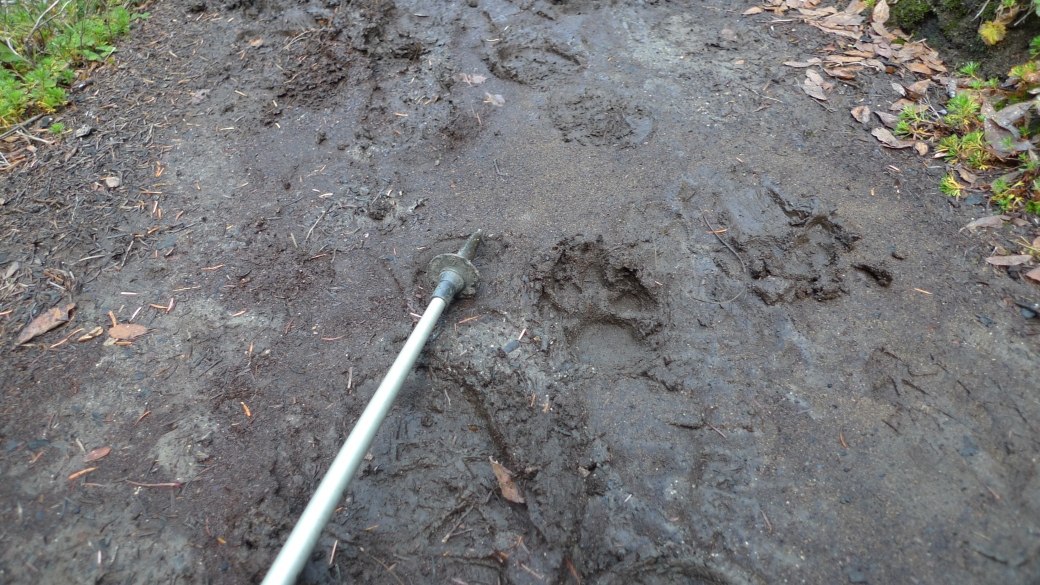
P1020271

P1020281

P1020288

Cougar Tracks!

One of the nights however, we were brutally reminded of how late in the season it was getting. At the end of the day, we ended up at a campsite at the edge of a shelf in a deep valley. It had gorgeous views, but being at the bottom of the valley and exposed, there was a constant below-freezing cold wind. This was by far the coldest night we had experienced on trail, more due to the wind chill than anything else. Everything was frozen solid when we woke up, shoes, clothes and tent. It was one of those mornings when you get moving as quickly as possible, because once you are out of your sleeping bag, you start getting more and more numb without hiking.

P1020276

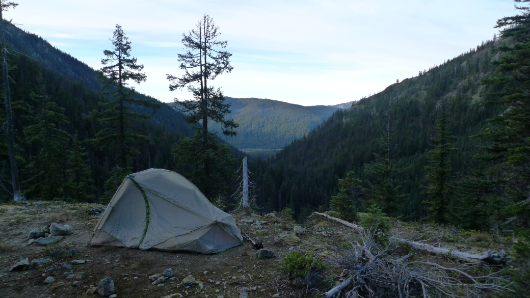
Sledd Dogg’s tent, battered from the freezing wind

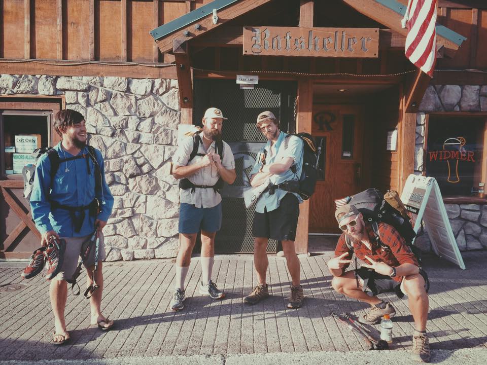
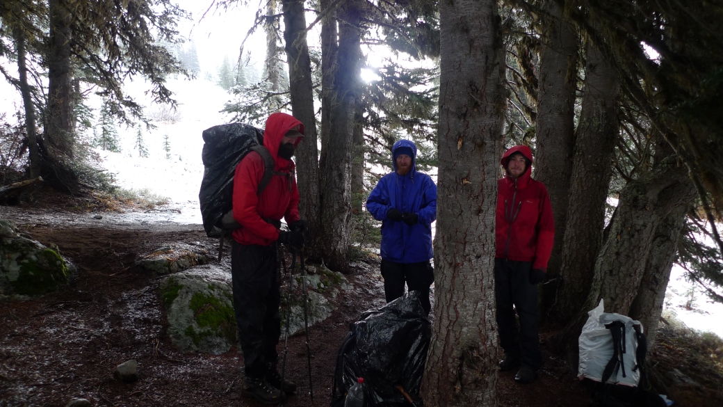
As we rolled into Steven’s Pass, Dupont was starting to get sick. We were apprehensive about going to the trail angel’s house there, as there was word on the trail that they were fairly strict. We decided to go anyway to save money on a hotel room, so that Dupont could rest a little, and so that we could avoid the weather coming in. It turned out to be a great decision, and that the Dinsmores were absolutely lovely. A group of hikers had stayed at their place earlier in the season and been extremely disrespectful and badly behaved (fuelled by alcohol). As a result, the Dinsmores had decided to ban alcohol at their Hiker Haven all together. Being late in the season however, and realising that we were pleasant well-behaved hikers, they allowed us to drink whilst we were there.

More bad weather was rolling in and we found ourselves having another debate whether to wait out the storms, or hike through them. The more we waited out storms, the more likely we were to be hit by bigger- and colder storms later on. We relaxed in the comfort of their hiker dorm with one other hiker called Whistler, watching movies and some confusing sport they call football, except they only kick the ball a couple of times per game. We were also visited by a veteran hiker called Stacey, who was in the area and popped by to say hello to some thru hikers. She has over 15,000 miles under her belt on long distance trails, so naturally we had hundreds of questions for her. It was pretty inspiring listening to her words of wisdom and advice.

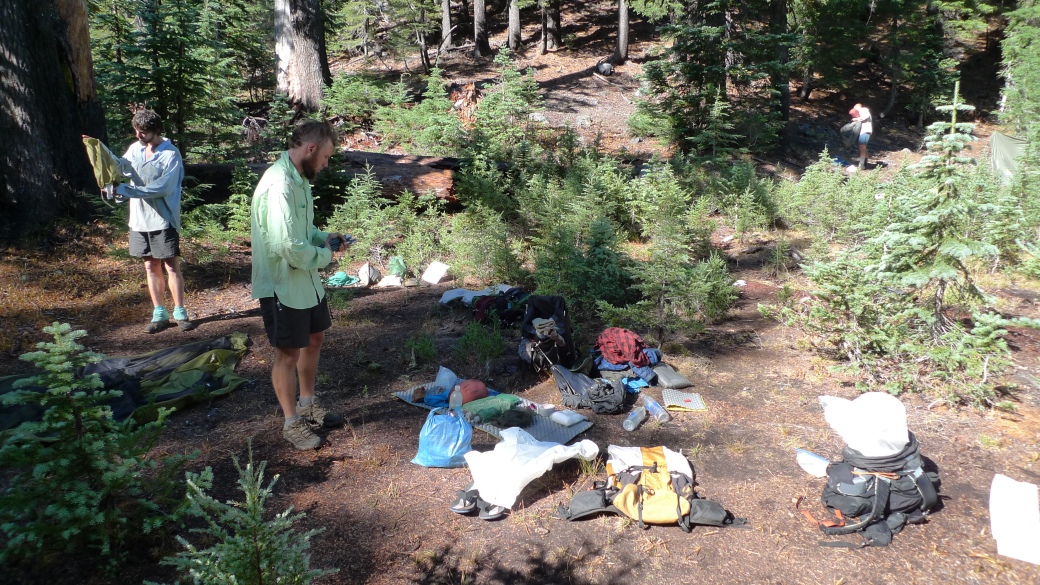
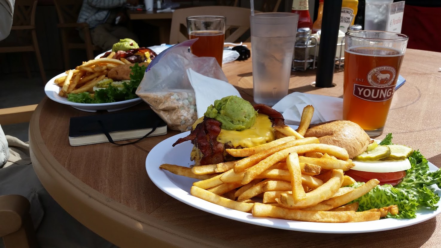
One day Jerry Dinsmore drove us to the McDonalds down the road, to take advantage of their dollar menu. Between the 4 of us, we ordered 40 burgers, to the shock of the employees and other customers there. We demolished our stacks of sandwiches like starved wild animals.

12242255_10107365059363874_1945006211_n

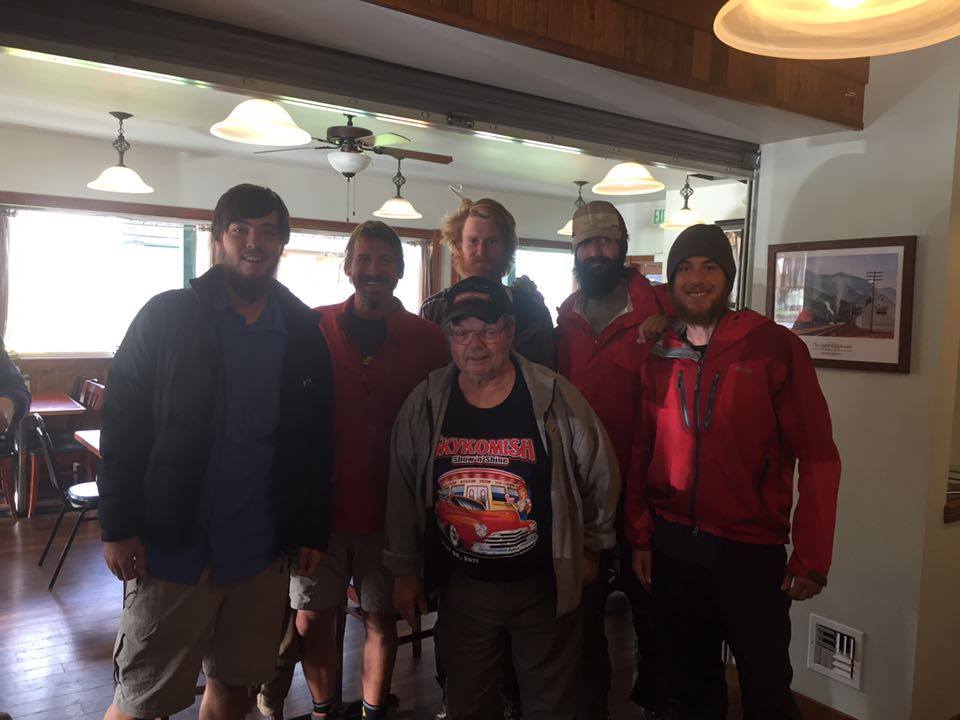
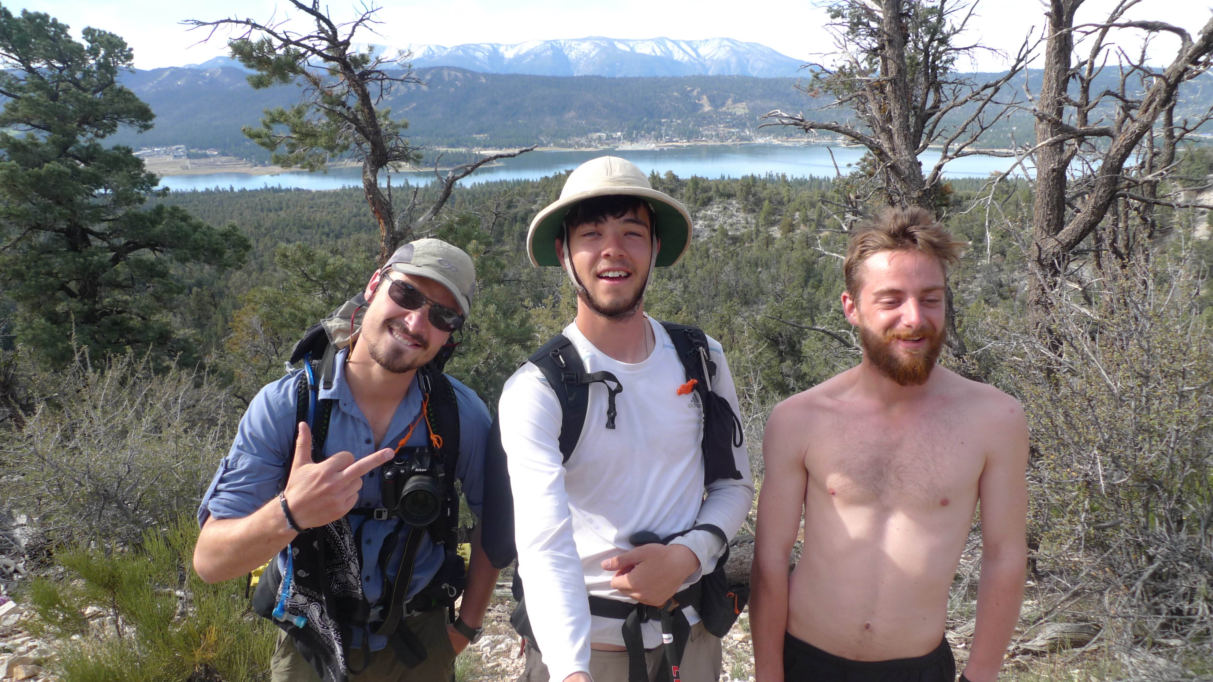
Left to right: Me, Whistler, Llama, Sledd Dogg and Dupont, with Jerry in the front.

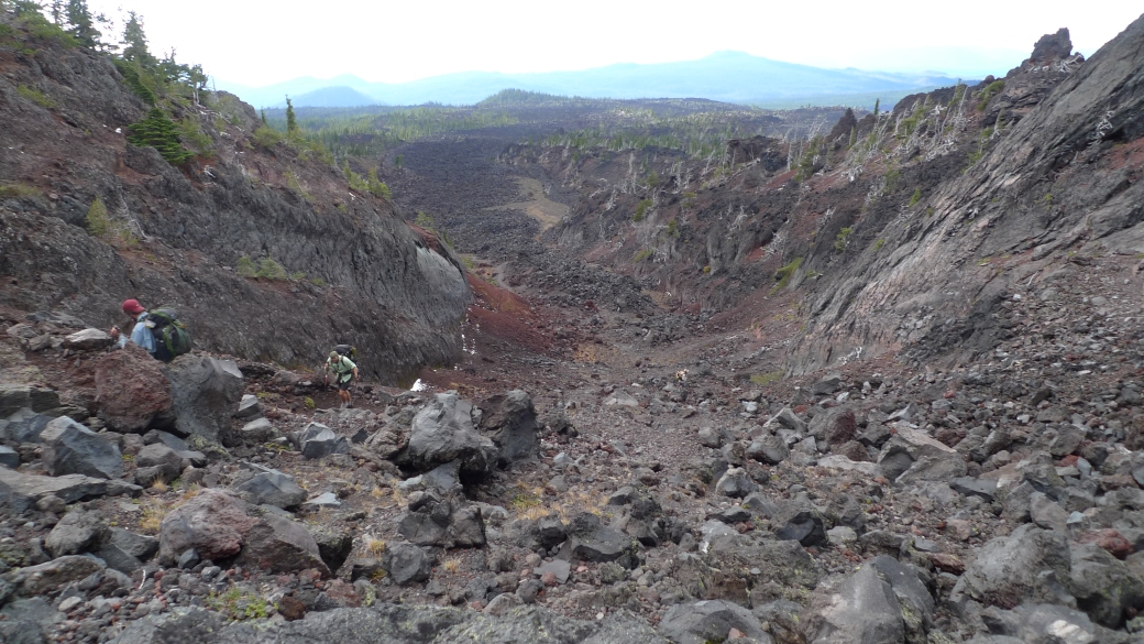
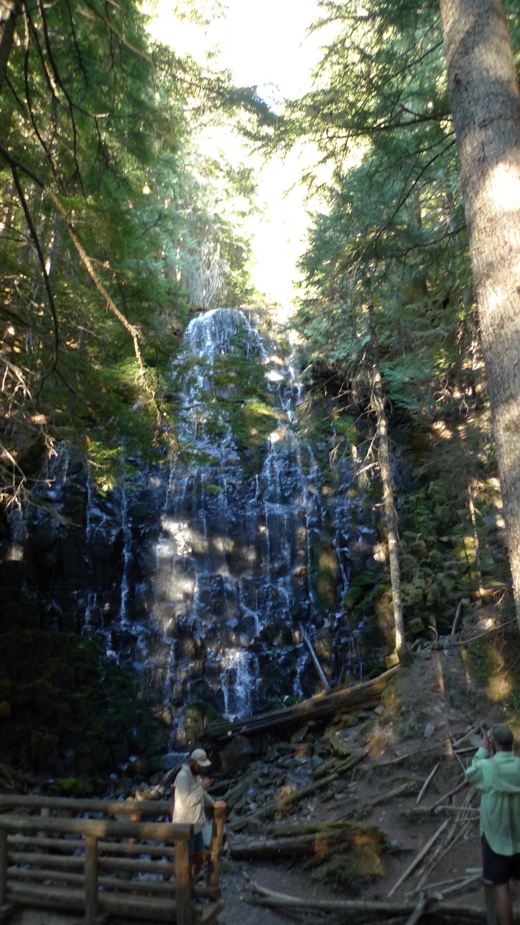
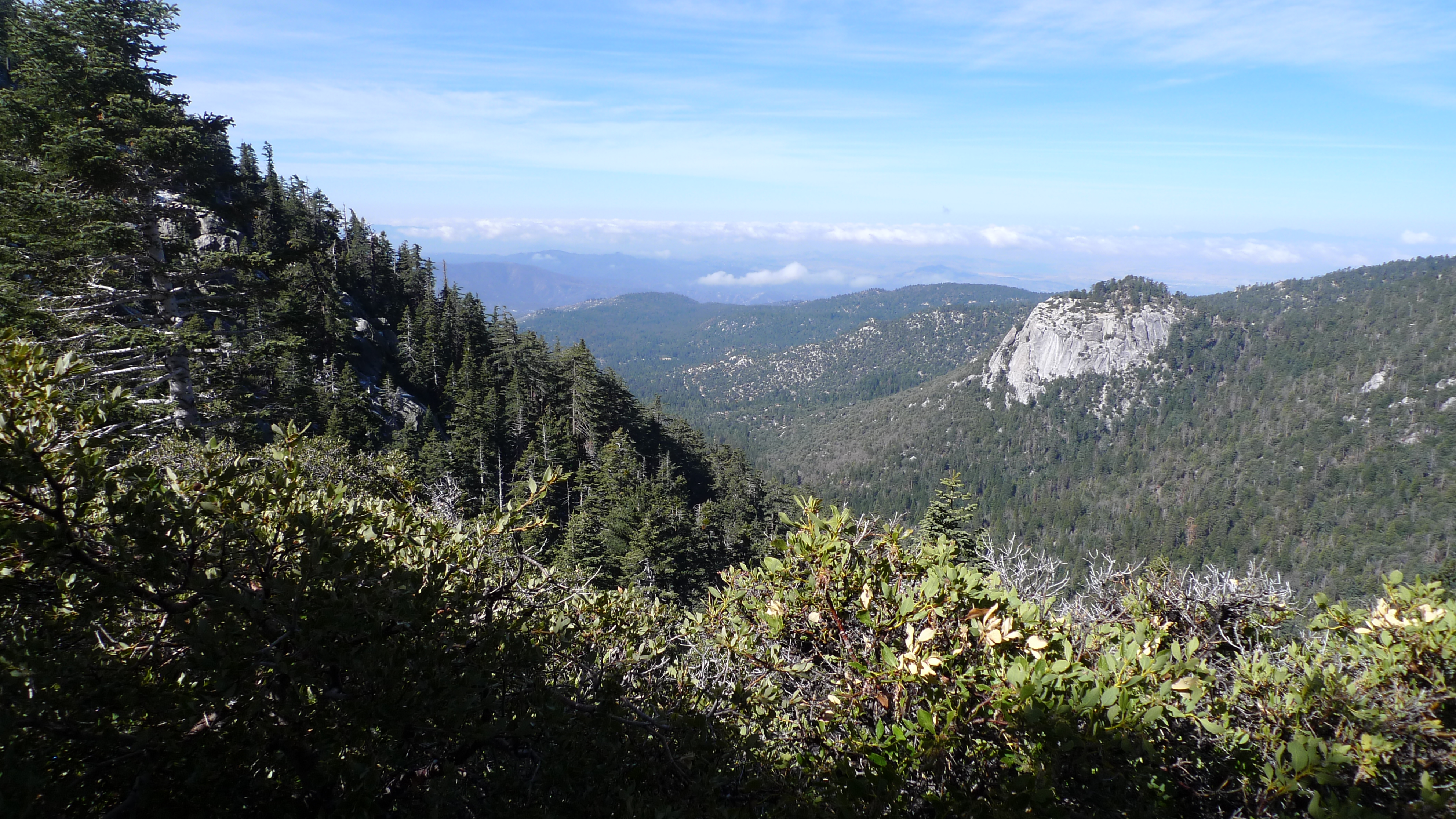
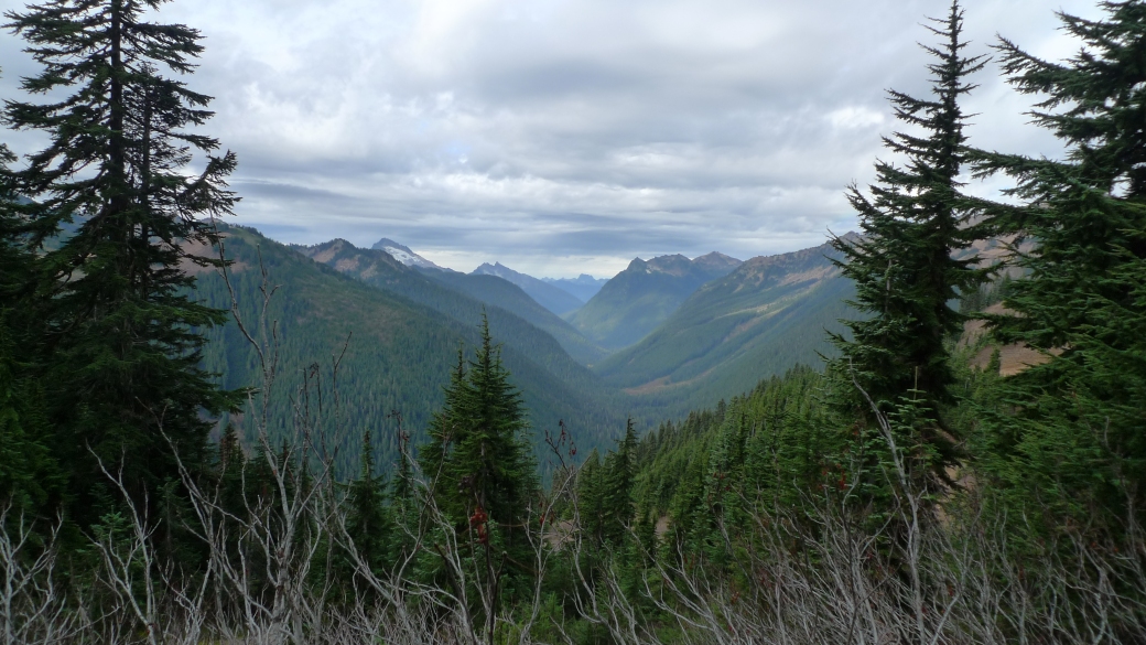
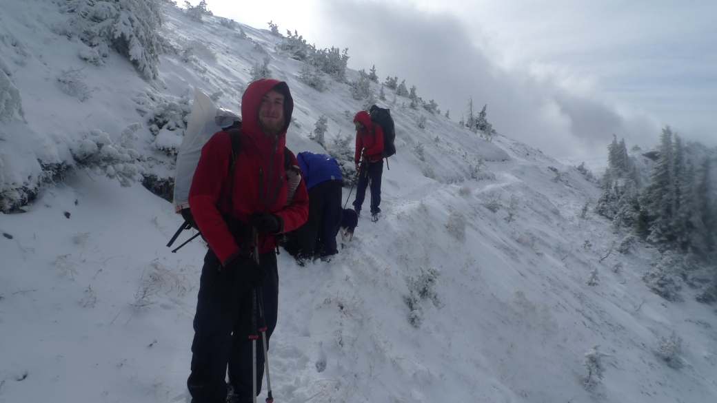
Although the rain had not stopped, the worst of the weather had passed, and Dupont was feeling better, so we decided to hike out in the rain. Our next stop would be a little town called Steheken. Standing between us and Steheken however, was 110 miles of one of the most remote and wild stretches of trail, as well as one of the most gorgeous.

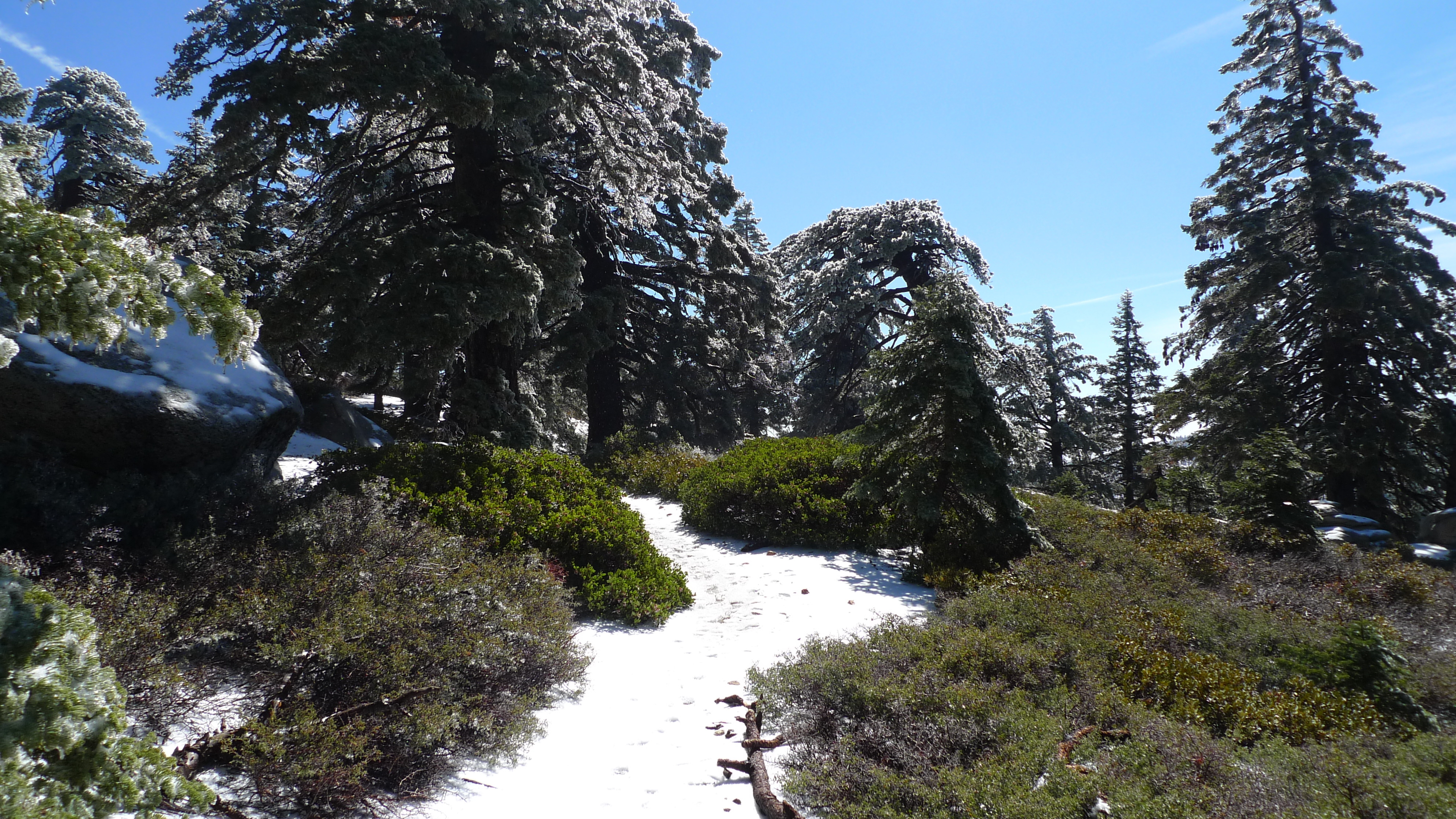
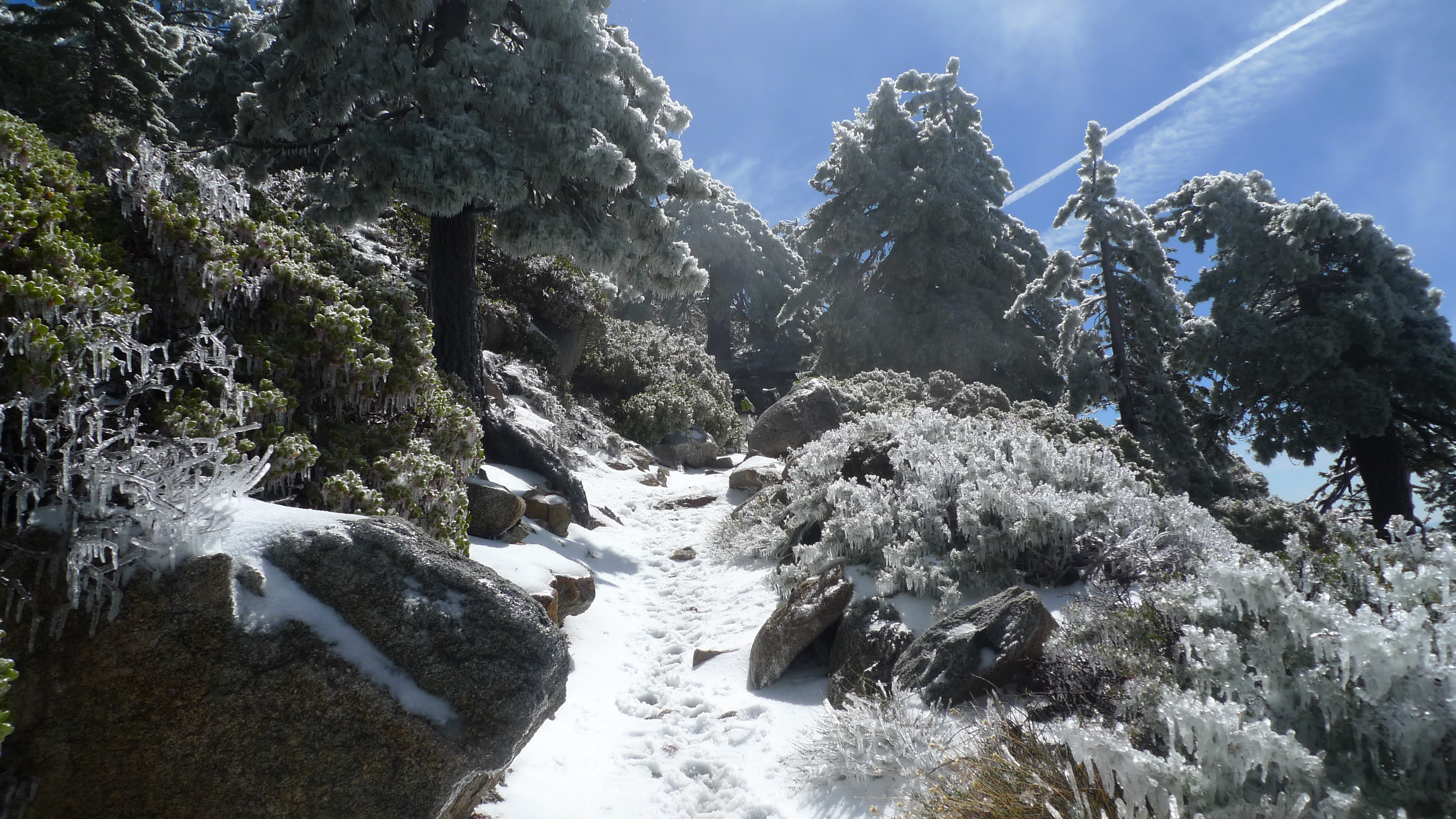
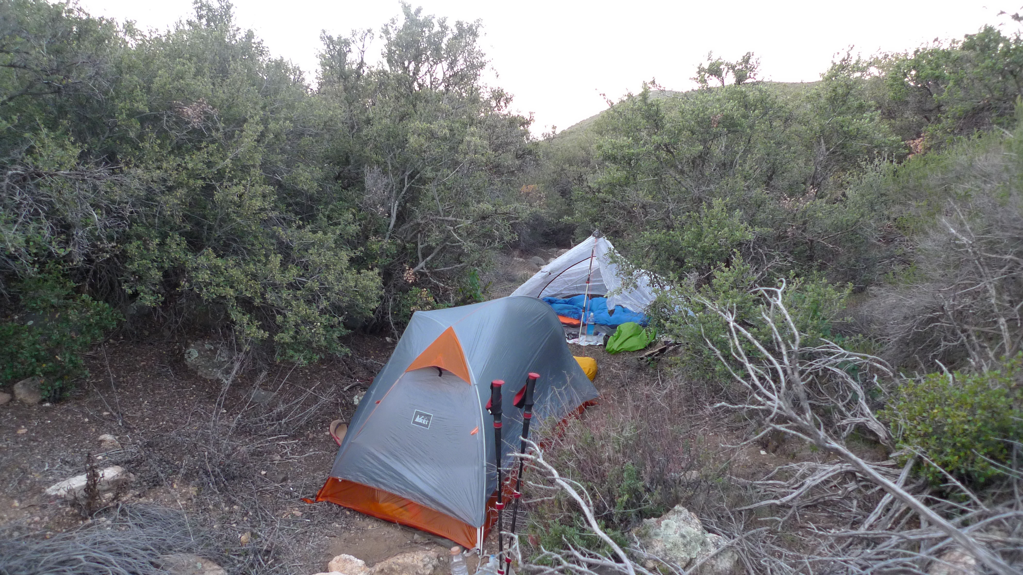
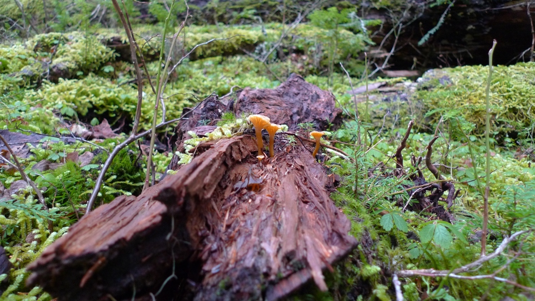
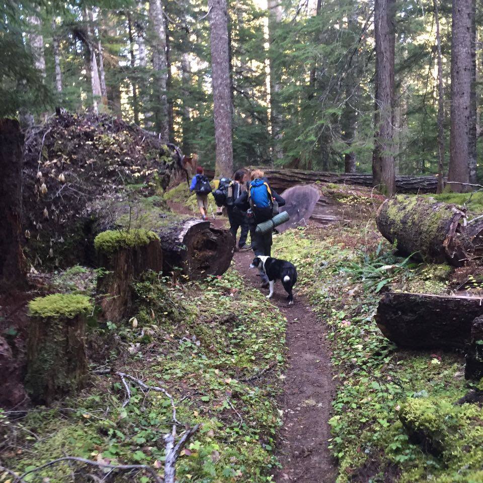
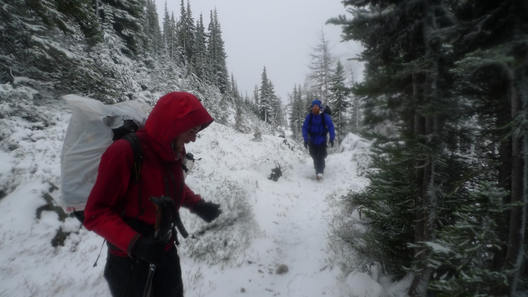
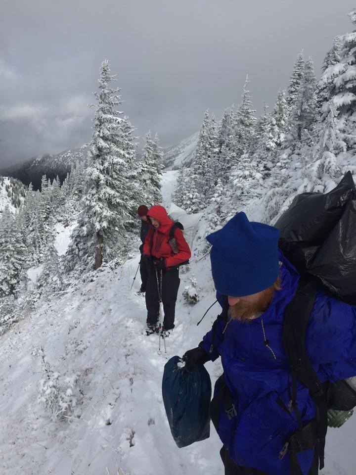
It really did feel like the winter was coming- in contrast to the long days in the desert where you could spread a 20 mile day over 16 hours, we were barely getting 8 hours of daylight to hike. When it wasn’t raining it was snowing, or at best, overcast. Warming up in the sun were days of the past. Now it was just about keeping dry, and managing the cold. Breaks had to be limited to 10 minutes or less, for risk of getting too cold. In the evenings once we got to camp, either we made a campfire, or got straight into our sleeping bags. It was too cold to sit around in the dark and relax. This regularly meant that we would be going to bed as early as 7pm and stay in our tents through till sunrise the next day. I say “stay in our tents”, because as anyone who has camped in washington will know, they have serious rodent problems at pretty much every campsite, so very often there was not much sleeping going on. All night, almost every night we would be terrorised by mice, rats, or chipmunks. They would crawl on, or if they can get there, inside our tents. They would chew any trace of food left in reach, and crap all over our stuff regardless of whether it smelled of food or not. Rodents were probably the worst thing about Washington- but that’s not saying much!

P1020289

12272670_10107365059189224_69176494_n

Crossing a stream

12244057_10107365057517574_1663304277_n

Taking a lunch break

P1020294

P1020299

P1020300

P1020303

P1020314

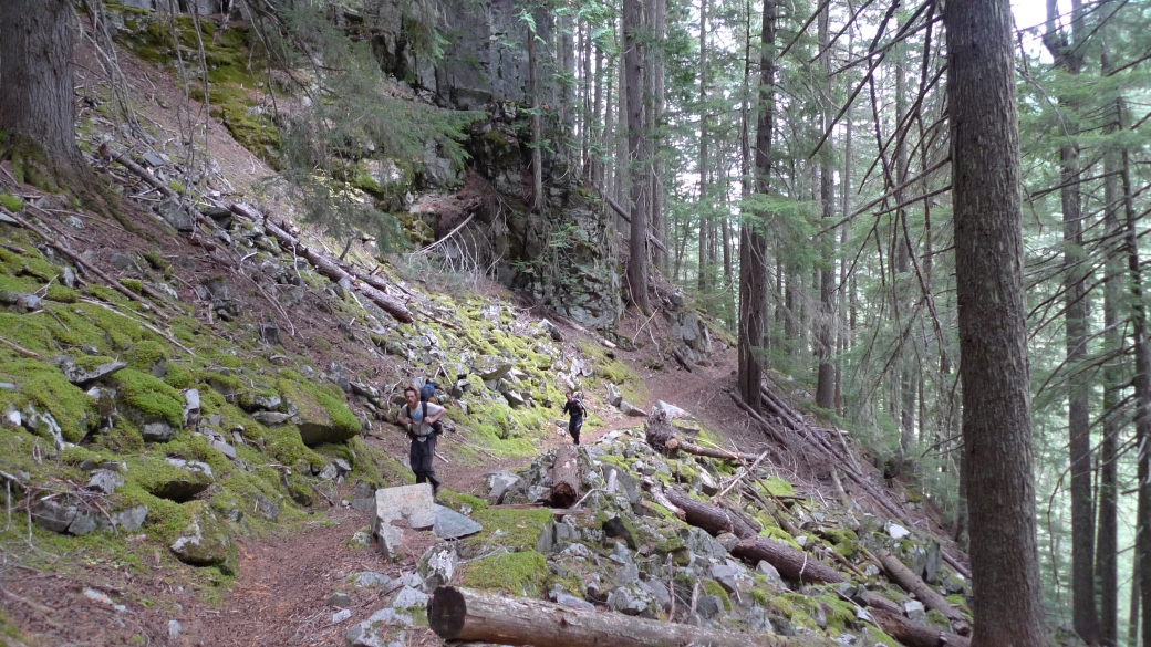
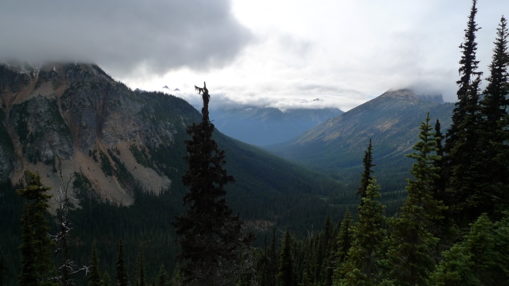
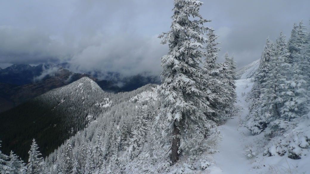
The elevation also started to feel like the High Sierras again. Every day we would be climbing up to a high pass at about 6-7,000 feet, and back down again to 4-5,000 feet. We had to make sure that we were down at lower elevations to camp, but also that we weren’t at the bottom of any valleys, otherwise it would get too cold at night.

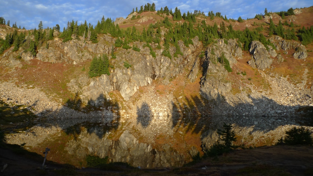
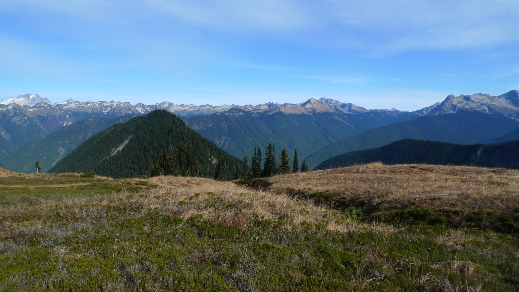
A couple of days before we reached Steheken, we approached an area that was said to have some of the oldest and largest trees on the whole trail. An area between mountain ranges, without any road access (hence the lack of logging) and the final deep valley we would walk through before Steheken. As we walked over a ridge and got our first glimpse of the epic valley, a magnificent bald eagle left its perch in a nearby tree and soared, majestically into the air. Within a few seconds and barely moving its wings, the eagle was thousands of feet above the valley floor. It was a magical moment, and one I will remember for a very long time.

P1020320

Epic Me + oaklee

As we walked down into the valley, I started to feel like we were in Middle Earth. There was very little trail maintenance in this section due to the difficult access, we were regularly climbing over fallen trees across the trail. We really felt a long way away from anybody or anything civilised. The trees got bigger and bigger, with some of the trunks as wide as 10 feet in diameter.

Dupont tree

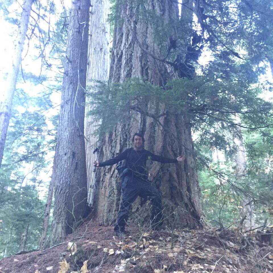
Dupont in front of a rather large tree

12244093_10107365056175264_140384387_n

P1020326

At the bottom of the valley the trail crosses the Suiattle River. on the approach They recently build a bridge that crosses the river, but that means a 5 mile detour to reach it. Instead, we decided to cross the river where the old trail originally went, over the river on a fallen tree.

The town of Steheken has a population of only a couple of hundred people, most of whom do not stay for the winter months. It is only accessible by foot on the PCT, or a 55 mile boat ride along lake Chelan. When we showed up, the whole town was closing down for the winter. The ranch was closed and the shop and restaurant only opened for an hour when the daily ferry arrived. Luckily because of the lack of people, we got a large discount on a room for the night, as there was another bout of heavy rain.

Steheken

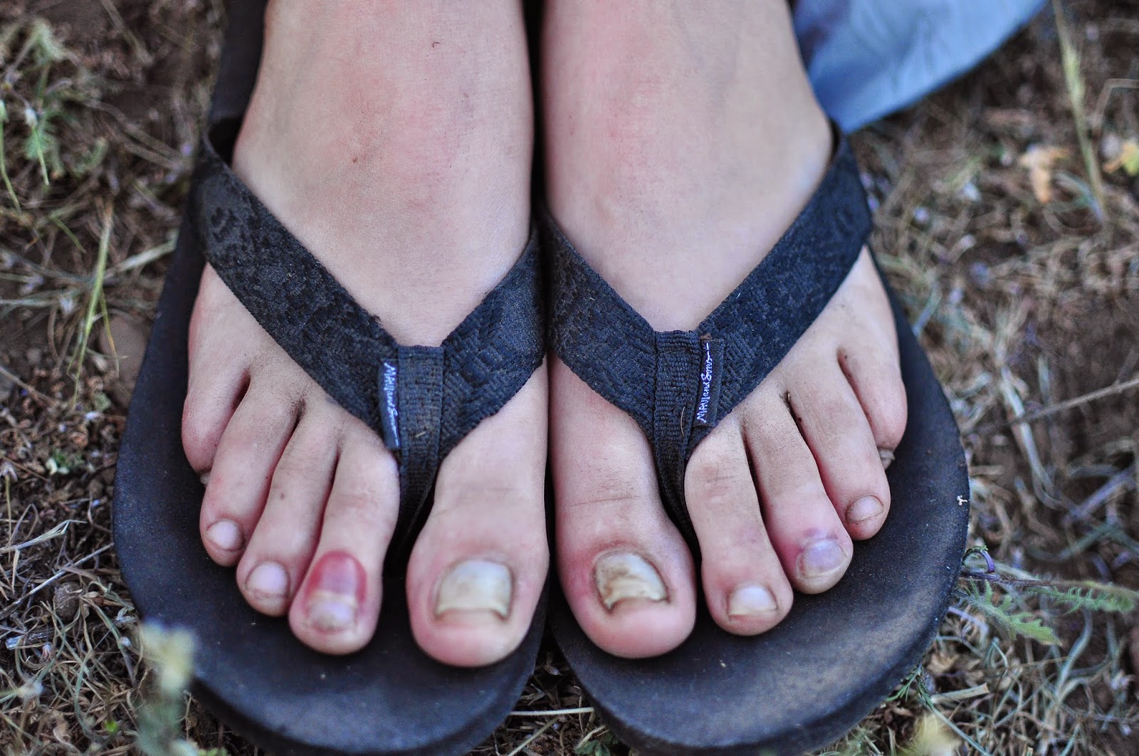
I was the only one of the 4 of us that still was wearing trail runners and not boots. One major advantage of wearing trail runners is that they dry out very quickly compared to boots. This is great in hot weather when you can dry out your shoes in an hour in the sun, however in Washington in October, there was no chance to dry out my feet and they just got wetter and wetter. I started suffering from really bad athlete’s foot, and unfortunately there was nowhere in Steheken that I could get ahold of foot powder to solve the problem. I tried some DIY waterproofing on my shoes using some old ziplock bags and superglue in an attempt to keep my feet dry for the next stretch.

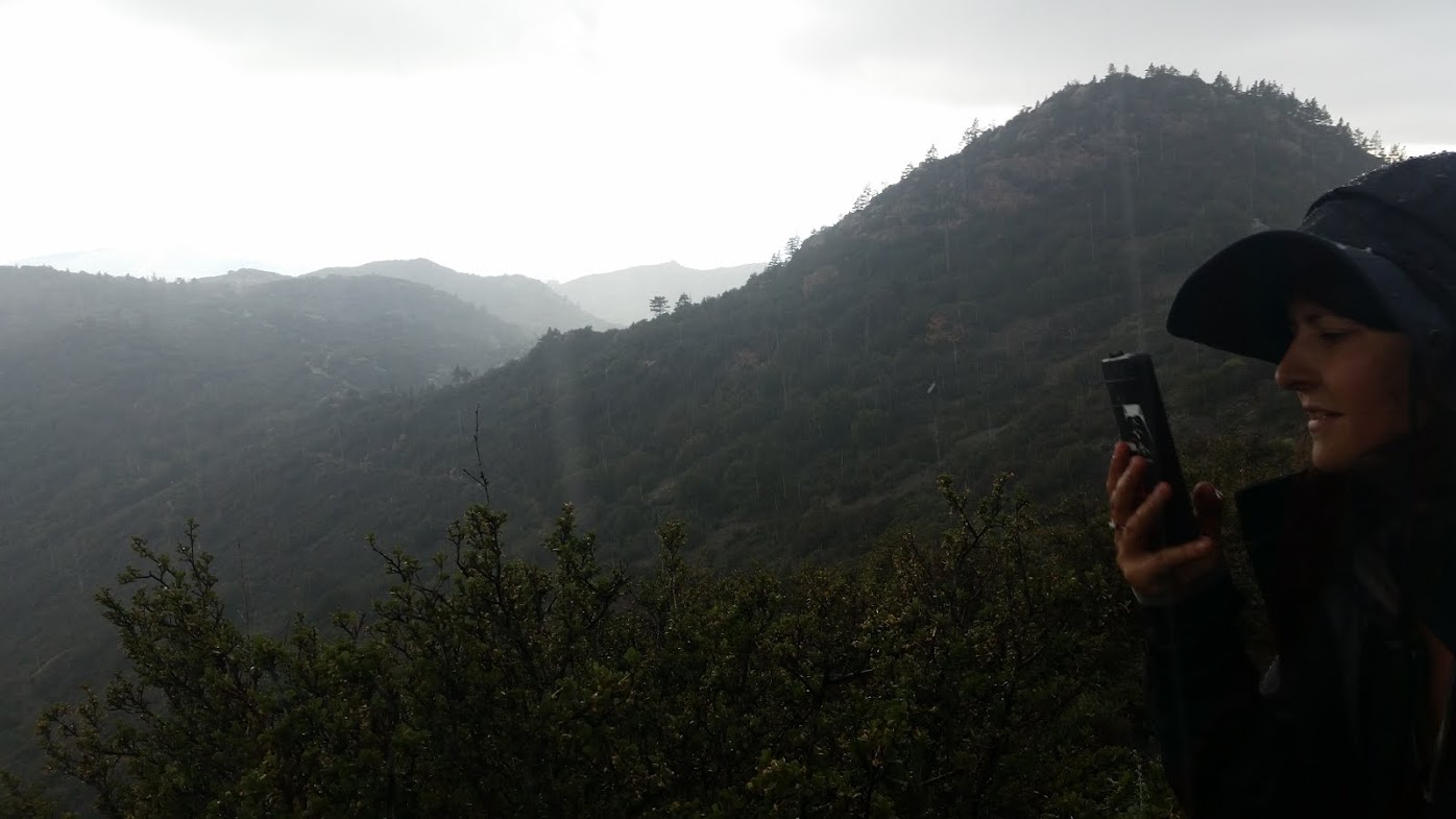
Watching the weather forecast was not very encouraging. As more time passed, more and more storms were forecast, with the temperatures drastically falling. In about 5 days from when we were at Steheken, a huge storm was supposed to cover the whole of washington with deep snow. The kind of snow that would start the winter ski-season. We had to get our skates on. After we got our packages from the post office the next day, we headed out as quickly as possible and made for Rainy pass, the last proper road before the Canadian Border. We hiked into the night and made it to rainy pass just after 11pm. Turns out there is a reason they call it Rainy pass! Soaked and cold, we threw our thumbs out in the hope of a miracle lift to a trail angel’s nearby place called Ravensong’s Roost. Incredibly, despite a lack of anybody on the road, a car came past and a chap picked us up who was heading the same direction. He was friendly, and said he had never even picked up any hitch-hikers before.

We arrived at Ravensong’s Roost in the middle of the night, not even knowing if we were in the right place. We walked around aimlessly for a couple of minutes, not wanting to disturb any neighbours before Ravensong herself came out of the darkness and welcomed us into the warmth of her hiker-hut. My feet were getting torn apart from being soaked constantly, and the athlete’s foot was only getting worse. The DIY waterproofing on my shoes was almost completely useless. They collected all the consensation from my feet, and made them even more wet. There was a hiker box there, as there is usually at stops on the trail, but it was almost completely empty. Only a few citronella candles and bags of unidentified food powders. Underneath some used insoles however, I spotted a almost full bottle of athlete’s foot powder. The trail definitely provided.

We didnt stay long, we were on a mission to beat the storm. The next morning, we stocked up on booze for the border celebration, and prepared ourselves for a 30-mile day. We decided to do a 30-miler firstly to make up time and miles, but also because It was going to be our last day without rain before the storms hit so it would be a good idea to get as far as we could whilst still being relatively dry. Dupont and Llama’s current longest day was about 25 miles, so there were also bragging rights involved in the decision.

Setting off at about 2 in the afternoon, We hiked through the night again, arriving at Hart’s Pass at about 4 in the morning. It was a full moon that night, so although we did miss some of the gorgeous views, we also saw some spectacular views illuminated by the soft moonlight.

P1020349

P1020344

P1020336

P1020351

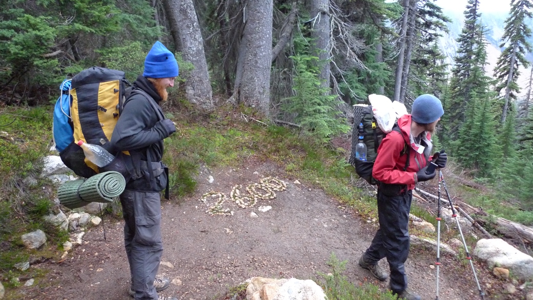
Llama and Dupont crossing the 2,600 mile mark

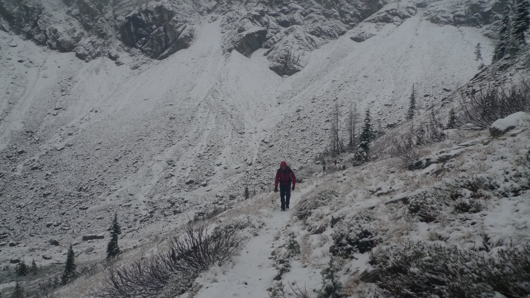
The next morning, sore and knackered from the previous night, we woke up to full on snow. All of our tents were covered with about an inch. Freezing cold, we wasted no time in setting off and getting hiking. For the next 2 days we were pelted with rain, sleet and snow. Barely taking any breaks, we walked until we got fed up, leaving about 15 miles to get to the border the next day. I had no time to worry about the state of my feet, which were still getting worse. We went up and over several passes that were covered with about a foot of snow, including the highest point on the trail in Washington. The freezing elevation was around 5,000 feet still, so above that, it was snow, and below it, rain. There were some points on the trail that were so scary, I actually feared for my life. All it would take was stepping an inch or two out of place, one little stumble and I would fall thousands of feet down to my death.

P1020352

The morning before we hit the border

P1020354

P1020358

Ridge

As we came up and over the final pass before Canada, the last major climb we would have to do on the whole trail, there was a break in the clouds, and we had a break from the precipitation for the first time in a day and a half. We even got a little bit of sun. What a reception!

P1020359

P1020360

Coming back down over the pass, with only about 6 miles to go until we reached the Canadian border, we felt invincible. Despite the naysayers, the weather, all the obstacles: physical, mental, emotional and also literal obstacles in the trail, Canada was only a couple of hours away. Everything we had done over the last 200 days had been leading up to this moment. Through all the pain, suffering and harships, but also excitement, utter joy and some of the absolute best times of our lives, our journey was almost complete. We had finally made it.

Having hiked 80 miles from Steheken in a little over 72 hours, we really did race to the finish to outrun the weather and I doubt we could have timed it any more perfectly. Although we were hit with some bad weather, it could have been a lot worse. Although we were certain that there was nobody behind us on the trail, we later heard word that there was a couple just behind us, who got stopped at Harts pass by a ranger and taken off trail due to the snow levels getting too high. I am pretty sure we were the last people to reach the Canadian border this year.

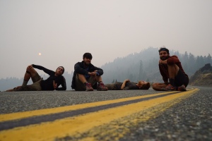
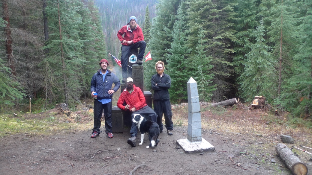
We reached the border in the early afternoon on 29th of October. We were absolutely ecstatic. The rain seemed to still be at bay, so we spent the whole afternoon celebrating, drinking and reminiscing about the trail, right at the monument. I would like to mention that Sledd Dogg hiked over 2,650 miles of the trail, and Dupont and Llama are one of the very few that kept up continuous footsteps from the Mexico to Canada. They did not miss a single step of trail. When we got rides back to the trail, they would ask to be dropped off, or walk back to the exact spot they left.

P1020371

Feet

My feet at the border, luckily the athlete’s foot had almost cleared up

Although we were completely elated at finally reaching Canada, the feeling was definitely bittersweet. Our journey was over. We would all head back to our regular lives back home. For all the comforts and amenities we used to enjoy, we would not have the same connection to nature. The trail is magical that way. The peace, the exhilaration, the danger. The trail has definitely changed me. I didn’t wake up one day and have a sudden moment of enlightenment, but over the course of the last 7 months, I have met hundreds of people, seen so many places, it felt awakening. I have learned so many things; about myself, the land, the people I met and about nature. Things I will carry with me back to humble England, and with me for the rest of my life.

Vancouver

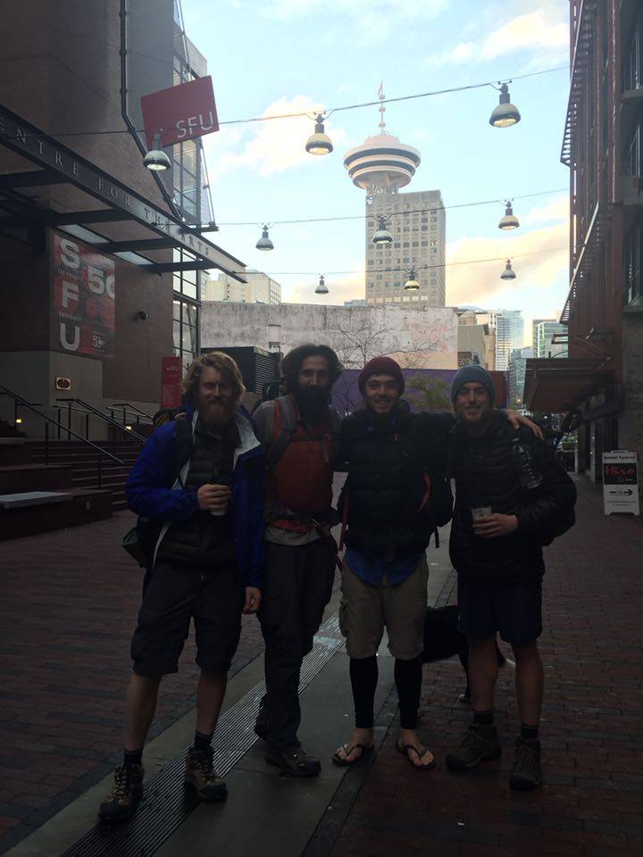
Llama, Sled, Me and Dupont just before we parted ways in Vancouver

It is important to remember that I could not have done this trail by myself. There are so many amazing people that made this experience not only possible, but the trip of a lifetime. Firstly my parents and sister for helping out financially, with the initial logistics and planning of the trip, and also giving me emotional support. I definitely could not have done any of this without them. I would like to thank Peter, a family friend that helped me out financially and with necessary  equipment (I was not the best at planning, or sticking to a budget). Also to David, in Berkeley who handled and sent out my resupply packages to me. Eric, Deana, Sabrina and Lucas, who put up Possum and I at their place in Sacramento for a week, and Ira and Kimberly, who’s place in Seattle I stayed at. Susan and Chantal in Portland, and also Nancy in Ashland who helped me out and really cared when I needed it the most. There are countless random people I met who were extremely generous to host me, and other hikers, who at the time were strangers to them, but brought us into their homes. All the amazing trail angels that gave us rides, left us food in the trail, and generally went long ways out of their way to make our hiking experience a little better.

Last but by no means least, I have to mention all the incredible characters that I met along the trail, in the form of other hikers. They are some of the most amazing people on this planet, and their personalities are like beacons of light. Especially the likes of Burgundy, Nailz, Foxtrot, Possum God, Dupont, Llama, Motown, Juicy Lumber, Jangles, Blackpaw, Lupin and Sledd Dogg, who had the biggest impact on my hike, but also many many others who aren’t any less important. Apologies If i didn’t mention anybody I should have!

Having still got about 20% of the trail to hike, the PCT and I have unfinished business. I was planning on visiting the west coast of the US again anyway, but this gives me the perfect excuse to go back! Thank you so much for reading this everybody, and I hoped you enjoyed it as much as I did.

12271227_10107365058989624_146214894_o


Trails and Tribulations in Oregon

A week after catching Dupont and Llama at Mazama village, I was still nursing the injury the chase had caused me. Walking any amount of small distance was painful. I spent hours trying to educate myself via the internet about therapeutic exercises or recommended stretches to help my shin, but nothing seemed to work. I was getting serious trail anxiety.

Having felt as though I was one of the last Northbounders for the previous stretch, I was worried that any more time off would leave me unable to finish the trail by the time winter came. Not only that, but I would probably be hiking the rest, or most of the trail by myself. I had a big decision to make. Once my foot feels better, do I go back to Mazama and hike north from where I got off, or do I skip to somewhere further up trail and hike from there?

The first option would mean that I would probably not see any other through-hikers for a long time, and maybe never catch up with my friends ahead of me. It also meant serious risk of getting hit by the winter nearer the end of the trail. Trying to rush and make up miles did not seem wise after the result of my last attempt. The latter option would mean that I was skipping trail, and that I would probably not be hiking the whole trail this year. After a lot of humming and hawing without my foot feeling any better, I decided that it was better to skip up ahead. I figured if it turned out I could have made it before the winter without skipping, I would have time to go back south and hike the sections I skipped once I reached the end. A few days later, I found myself in Bend, Oregon, and finally found the first through-hikers I had seen in a while.

Sitting round the back of REI I found Juicy and Lupin, who I had last seen in Tuolumne. Lupin came out from Texas with his brother Blackpaw, and friend Jangles, and had collectively been called The Three Bro-migos. Somewhere between Campo and here, they had been hiking with the Jamaican Bob Sled Team, and formed a larger crew including Juicy. Jangles went through a period of reading The Lord of the Rings to the group from his tent before bed, so they picked up the name The Fellowship (of the Ring). Remarkably, at the top of Mt. Whitney back in California, Jangles actually found a wedding band, with a note to whoever finds the ring to take it on their adventures with them! He put it on a chain around his neck, and from that day forward, they would forever be known as ‘The Fellowship’.

IMG_0741

IMG_1043

Bend was one of my favourite towns on the PCT. They are famous for their breweries, and the people seemed to be endlessly friendly and generous. Jangles and Blackpaw showed up and we stayed there another couple of days. During the daytime, we would hang out all day in a different fast food joint, and each night getting offered to stay at a different person’s house who we usually met playing pool at a bar.

Although my shin was still sore and tender, I had no choice but to try to hike on it. I was spending too much money being in town on beer and chicken burgers, and was starting to feel like I wasn’t a hiker anymore. Lupin had a serious leg injury, so stayed in town, but Juicy, Blackpaw, Jangles and I hitched a ride to Elk Lake and back to the trail, 13 days since I had hiked last. We camped almost at the trail head, as it was raining pretty hard and already late in the day. My injury seemed to be a lot better, and this time hiking actually helped heal the remaining discomfort. The next day was raining even harder, and we decided to camp after about 11 miles next to a lake. We ran into No Trace and Unbreakable, who were going southbound, doing a flip flop hike. They were the couple that had given me the pack and sleeping pad I was using, and let me stay in their cabin to escape the storms back in Idyllwild – what seemed like years ago. The next morning, the hail and rain was coming down so hard, we decided to wait it out for a bit in our tents. It was unrelenting. By about 2pm, we resigned to take an on-trail zero day to wait out the storm. There was a mini stream/pond forming underneath my tent, but luckily the bathtub proved to be sufficiently waterproof.

Because we weren’t moving, it was getting extremely cold, and sitting in your sleeping bag all day becomes uncomfortable and makes you ache. I decided to make a fire. Despite everything being completely soaked, we managed to dig for some bits of dry tinder, and break apart some fallen trees for some semi-dry, half rotting wood we could burn. Still pissing down with rain, we struggled to get it going, but eventually managed. We sat round the warmth all evening in the rain, alternating between warming/drying our fronts and backs in a constant cycle.

We woke up the next day to a beautiful morning. High Water, a hiker who I hadn’t seen since the Sierras was also doing a southbound flip-flop came walking past, and we had breakfast and caught up. We dried our stuff out in the sun, and hiked round the corners to see the previously non-visible Sisters Mountains in all their glory. They had been towering over us for 2 days, but we were oblivious because of the rain and weather.

P1020189

Left to right: Blackpaw, Jangles and Juicy drying out their stuff

P1020191

We hiked a beautiful 15 miles that day, and ended up at another lake called Frog Lake to camp for the night. Wanting to make the most of the good weather, we decided to cowboy camp. There was a freezing wind all night, which brought moisture from the lake right over us, so although it didn’t rain all night, we were getting soaked as if it was! The wetter we got, the colder we got as our bags became less efficient. In the early hours of the morning, it was so cold I could no longer sleep. I just stayed awake hoping that the sun would rise before it got so cold I would have no choice but to pack up and get moving. As soon as I could see any hint of sun, I got up out of my bag, and layed all my stuff out for a second morning to dry out.

The trail in Oregon seemed to follow a line of huge volcanic mountains surrounded by relatively flat scenery. It made for incredibly epic views, and vast fields of ancient lava flow.

P1020193

Although I was thrilled to be healthy and back on trail, I had far less motivation than I did before. The scenery was gorgeous, and I was enjoying myself, but I felt no race anymore. In the back of my mind I knew I wouldn’t make it to Canada before the winter hit, and I had already skipped a section, so either way, I was not going to do a full thru-hike this year. All I had left was to enjoy the rest of the time I had on trail. The others I was hiking with had also missed a huge section in Northern California, and were planning on finishing their hike in Cascade Locks – the end of Oregon, so none of us felt any pressure to be doing miles.

P1020199

All of these factors combined, along with being soaked for several nights in a row and not drying out properly, made it an easy decision to go into a town called Sisters and relax. We spent 2 nights there recuperating and eating junk food, in no rush to leave. We got back on trail, and only made it one mile before deciding to camp early again at the edge of the lava field. The following day we hiked to a place called Big Lake Youth Camp, a summer camp that had already closed, but they left open their facilities for thru-hikers. There were no staff at all, but they had a hiker room we could take shelter in, and they left the laundry and shower facilities open for us. We rested there for the afternoon with some other southbound hikers and section hikers, enjoying the gorgeous view of the lake.

P1020196

Having made little progress over the previous week, we found ourselves debating skipping another section. Mainly because we were still way behind schedule to finish before winter, but also to try to catch up with Dupont and Llama, and also because the others had to be in Cascade Locks by a certain date to finish their hike. 7 miles after Big Lake, we hitched back into Sisters on Highway 20, filled up on fast food, and stuck our thumbs out once again to try to get up to Timberline Lodge, another 100 miles North by trail. We eventually got a hitch to a town called Redmond and found our way to the closest fast food place, which happened to be a Taco Bell. A kid that worked there was enthralled by us, and fired a load of questions at us, before giving us some free donuts. We wandered over to a bar, where more locals bought us free drinks, and one bloke called Aaron offered us to stay at his house. I ended up Canadian-leg wrestling a lady at the bar, who actually beat me despite my muscular hiker legs (it was her technique that won it for her). Later we went back to Aaron’s place, where he showed us his gun collection (including antique shotguns and an Uzi), his weed farm, and his large fishing boat. We slept on his sheltered porch watching the hobbit next to a wood fire.

The following day, Aaron generously gave us some frozen tuna steaks that he caught himself, and gave us a ride back into town. I think his wife was not happy that he had drunkenly brought back 4 smelly hikers to stay. We stuck our thumbs out (but not before McDonalds for breakfast) in the hope to get up to Timberline Lodge that day. An old rocker lady picked us up, and drove us part of the way to a town called Madras. She dropped us off at the edge of town in the middle of nowhere, so we stuck our thumbs out again and got picked up by a Native American fellow who worked at a nearby casino. He drove us as far as a place called Warm Springs, an incredibly beautiful place. It’s a town at the bottom of a river valley, luscious and green in the middle of Oregon’s high desert. Our final lift came from a lovely girl called Hannah on her way to Portland who drove us to Government Camp, a short bus ride away from Timberline Lodge.

P1020207

Trying to get a ride in Madras

We ended up staying in Government Camp longer than we would have liked. Mostly due to the miserable weather, but also waiting for packages that I had forwarded, which in the end the weather cleared up and we gave up waiting for. We spent 2 days in a bar called the Ratskeller, which had delicious burgers, and a seriously addicting Sopranos Pinball machine which blurted out expletives and profanities during gameplay, and which I probably spent over $40 on.

Ratskiller

Outside the Ratskeller

We tried out the much-hyped Timberline Lodge breakfast buffet, but were sadly disappointed. It was probably that we had not been hiking for a little while and had been spoiled on fast food and the delicious Ratskiller burgers, but it was nowhere near as good as it was rumoured to be. Also apparently the lunch buffet is the one to go to – they had unlimited tri-tip steaks.

Finally we made it back onto the trail, to more absolutely gorgeous views from around Mount Hood. 

P1020209

The following day, we did a 20-mile day to reach the start of the Eagle Creek Trail, the first 20-miler since the beginning of Oregon, and it was tough. Eagle Creek trail is an alternative trail that will take you into Cascade locks, where you can see Washington right on the other side of the Columbia River.

In the morning, we hiked down a short, but ridiculously steep trail to cut across to the Eagle Creek alternative, and discovered one of the most beautiful parts of the trail. 15 miles of stunning waterfalls, creeks and cliffs.

P1020214

P1020218

P1020222

P1020227

P1020235

P1020237

We were walking up to a famous waterfall called Tunnel Falls when I heard some commotion up ahead. It turned out that Juicy’s girlfriend Bree had flown up from San Diego to surprise him by meeting him inside the falls. He almost walked right past her, saying “excuse me” as he tried to squeeze around her in the tunnel, before realising it was his own girlfriend! Lupin was there, too, having spent the last couple of weeks with his knee injury. We all hiked the last few miles into Cascade locks, where Bree’s rental car was waiting. We got some booze and celebrated The Fellowship’s last night on trail.

P1020259

Me at tunnel falls

The next day, the others took off to Portland to start their journeys home, leaving me at a trail angel called Shrek’s house. I had heard all sorts of good things about Shrek’s place, about how it was a good party spot, and Shrek was really nice. When I got there, there was not a single other hiker in sight. Not even Shrek was home. I relaxed in the yard, and considered the journey ahead of me. When Shrek did come home after work, he was nice, but seemed fed up with the whole through-hiker thing. I guess he had been hosting for months, and just didn’t have the enthusiasm for it anymore. He was going to close for the season the next day anyway, and said he hadn’t seen any other hikers for a long while. I showered, did my laundry, grabbed a book from the hiker box, and got ready to hike out the next morning.

Walking over the famous Bridge of the Gods was an anti-climax for me. Normally it is an inspiring moment for people – they have finished hiking through Oregon, and are about to enter the beautiful Washington state; the last state on the PCT. For me, I felt alone and deflated. Having skipped half of Oregon, I didn’t feel the same accomplishment as I would have, and the thought of hiking through the 500 mile-long state of Washington by myself with increasingly worsening weather was daunting. It seemed as though whenever I got close to a group of hikers I was hiking with, they inevitably ended up getting off trail, leaving me by myself. First Nailz, then Possum, and now The Fellowship. There was still something deep down that was pushing me on, preventing me from getting off trail and going home. I reasoned that no matter how much I had skipped before, I needed to persevere. I came out to hike, alone or with other people, but the events that led me to where I was, left me ultimately feeling defeated.

A feeling of loneliness combined with freedom came over me. For the first time, I was faced with hiking a very large section without company, or even the prospect of it. I had hiked alone before, but I was usually catching people up, or others were going to catch me up. But from here north, I was completely alone. That meant I was not hiking on anyone else’s schedule. No waiting for other people’s breaks, meals, resupplies, I could go and do what I wanted. A sense of bitter-sweet liberation.

The weather for my first few days in Washington was unforgiving. Although it didn’t rain during the day, there was so much fog and mist, that all the plants were covered in moisture. The trees were dripping water constantly, and the small bushes jutting out into the trail soaked my shins and feet as I walked by. It might as well have been raining. It felt like a rain forest. The first night, I set up camp in the early afternoon, lacking any motivation or drive. There was nobody to inspire me to keep going, and similarly, nobody who I would feel guilty about holding up. I spent the rest of the afternoon collecting making a ridiculous amount of firewood for my fire, more than I could burn in days. I also finished the book that I had picked up at Shrek’s less than 2 days before.

I pushed on. Another couple of nights of no views, getting soaked by the non-existent rain, and taking shelter in my tent from the rain at night did no good for my enthusiasm. I started to go crazy a little bit – as I had done before when being alone for days at a time. Conversations with myself, swearing loudly at things for no reason, asking questions to the trees – the usual stuff.

Finally it all caught up with me. On day 3 out of Cascade Locks, I was feeling miserable, alone, and just wanted to go home. For the first time my entire trip, I had serious thoughts of quitting the whole trail. I passed some day-hikers and had a brief clinical chat. But as I passed their car on a road a few miles later, I sat by the road seriously considering waiting for them to come back and asking for a ride to the nearest town to head home. I decided against it, and camped a few more miles up trail, next to a stream. I spent the evening trying to make a huge decision.

Here is the raw emotional diary entry from that night:

“I had my first real thoughts of quitting the trail today. I am so fed up with it – all I want it someone to tell me it’s going to be ok. Some comfort, but I don’t even have a person to spit at, let alone converse. I want to sleep in my own room, to wake up and not have to pack up everything I own before I can get on with my day. I want a voice when I feel alone – even if it is the TV or radio. I want to be comfortable – to have a chair to sit on, carpet to lay on, a clean plate, cup or bowl when I need it. A tap to drink from without having to laboriously squeeze every drop of water you drink through a filter. To have a dry place when it rains – a place bigger than a small coffin.

But this is why I came out here- to suffer and work hard. Have I suffered enough? Not only did I come out here to suffer, but I came out here to live. To live life to its fullest before incarcerating myself in an office or laboratory. To learn what life is about, mine and other people’s – and boy have I learned what other people’s lives are about. Out here, people’s lives are about living – working to live, not living to work, as so many people’s lives are back in London. So much so that I was getting dragged into it myself.

Only 3 weeks more to Canada. Is that my goal? Was it ever my goal? My goal has changed so many times whilst I have been out here. What even was it in the first place? I don’t think I ever really knew – but I did know that this journey would change me, and that it has. I have walked almost 2000 miles, seen places, animals, plants and insects that most people will never get to see. I have met more people than I will ever remember. I have made best friends, and hopefully lifelong friends. I have been inspired, and inspired others. I have lived in my own filth – and other people’s – for weeks on end. I have pushed my body further than I ever thought it could go – and further. I toned my body into a hiking machine. I discovered my limits, and went past them, I have pushed myself to what felt like the border of insanity. Is that not why I came out here? To push myself, so when I got back to the real world, I know how far I can push? 3 more weeks. 500 more miles.

Will it still be raining when I wake? Will I have the motivation to get myself out of my tent and hike another 20 miles of misery, pain, wet and cold?

I came out no athlete – no through-hiker, just an average Joe wanting to experience something incredible – and that I have. I came out here hoping to finish, but half not expecting to. I have gone way over budget, over time, and travelled further than most thought I would. I have been out for almost 6 months, walked almost 2000 miles, and still have a state and a half I haven’t walked through.

I came out here with such zeal, and maintained it for months. I had no idea what I was getting myself into – and that was a lot of the fun. But now a few months on, I know what this is all about. I have spent more days backpacking this year than most do in a lifetime, and even avid backpackers will in a decade.

I was expecting this trail to be long, but never as long as it actually is. I’m not sure there are many others with as little experience as me when I came out, who have made it as far as I. There are a hell of a lot more that came out with far more experience, and made it nowhere near as far as I have.

Is this the end of my hike? Reading over the last few pages sounds like it is, but there is something nagging at me, something still stopping me from walking to the nearest road and hitching to comfort and home. Will I regret it if I finish my hike here? It’s not a matter of pride, or it shouldn’t be. Nobody can discredit what I have already achieved, and the only people I will be letting down are those with over-inflated expectations of me.”

The next morning, I got up, had a really slow morning feeling even more miserable. I hiked up to the first ridge where I had phone signal, and made some emotional phone calls to my parents and to Possum, before deciding that it was time to get off trail. I hiked another 10 miles before the trail crossed another road. I had no idea where the road led, or how busy it was, but this was the point where I was going to go home. I was done.

So I thought..

P1020239

Last of the Northbounders

Since I last posted, I have finally crossed over the border into Oregon, after spending a gruelling 4 and a half months in the state of California. The final couple of hundred miles felt like a race to get out of the state. The weather was getting increasingly hot, the smoke was becoming almost suffocating and we had all been hearing good things about Ashland- the first town on the PCT in Oregon.

P1020145

Trying to get a ride into town varies in difficulty depending on many things, but primarily how busy the road is that you are trying to hitch on. Often you try to time it so that you arrive in town before the post office, restaurant or liquor store closes, and it can get pretty tight sometimes. We have learned though that if you have been standing for a few hours, and give up 5 minutes before you would reach the shops on time, a car will always come past at the last minute- we call it Murphy’s Hitch.

IMG_4120

Going into Etna was a classic example. We were waiting all afternoon at Etna summit to get into town before the gas station closed at 10pm and only 2 cars came past. One was the same bloke who had a car full of gear so could not pick us up, and actually came past again on his way back out of town, and the other was a lady going the wrong way who laughed at us because we were trying to hitch after dark. We decided to wait until 9.20, as any later and we would miss the shop, but by about 9.10, we were fed up and all of us (Possum, Llama, Sled-Dog and I) apart from Dupont gave up and decided to set up camp a little way from the road. Sure enough, at 9.19 (I’m not exaggerating, it was literally 9.19), we heard a car in the distance approaching. We all stopped unpacking- by this point Sled-Dog was already in his sleeping bag drifting off, and us other 3 had all our stuff out ready for bed. Dupont stood by the road with his thumb out, and it was a lovely couple with a pick-up truck willing to drive us all into town. We speedily shoved all our things into our bags, jumped in the back, and arrived at the gas station at 9.59 just as the lady was about to close up shop. We took a zero in Etna and relaxed for the day.

FullSizeRender (1)

A few months ago before the trail, I was playing Xbox live, Call of Duty Zombies, and happened to be talking to someone online about the trail. It turned out they lived in Etna and said when I get up there he would give me a ride back to the trail. Sure enough, I gave him a ring and he generously gave us a ride back to the trial head.

P1020134

Seiad Valley was the next stop, which happens to be pretty close to the Emerald Triangle- so named because it consists of 3 counties that have the perfect climate for growing Cannabis. You could actually see numerous Cannabis farms from the trail as you hike. It was ridiculously hot in Seiad Valley, unbearably so, and on the hike in we experienced the worst face flies we have yet. Although they don’t bite, they just fly round your face until they decide to land on your eyes- attracted to the moisture. I ended up swinging my trekking poles around my face as I hiked for hours on end to keep them away- it’s the only way to stop yourself from going insane.

P1020138

We packed out a load of booze in anticipation of hitting the Oregon border a couple of days later. Possum and I even had a bottle of home-made port that was given to us by a guy in an RV in Castella who took pity when he had no room to give us a ride. The hike to the border was more green tunnelling (miles and miles of trees with no view) and even at the spots where we were supposed to have views, the smoke was so bad that we couldn’t see for more than a mile at some points.

P1020137

IMG_4121

There was a group of us that left Seiad Valley together, and when we finally did reach the border, we celebrated in due style.

P1020141

Border Celebration

I was not feeling great the next day at all. I put it down to the alcohol, and carried on hiking, but over the next few days, I started to feel worse and worse.

A couple of days later, we arrived in Ashland, a lovely little town full of hippies, artsy stuff, and a Shakespeare festival. They also have a spring there called Lithia spring, which is full of all sorts of supposedly healthy minerals and chemicals, including trace amounts of Lithium (which is used as an anti-psychotic drug). The strange thing is that this water is some of the most foul tasting and smelling water I have ever come across. It smells like someone is farting in your face. Naturally, we tried some and it tasted as bad as it smelled. As we were tasting it, a local came up and started chugging the water, raving about how healthy and delicious it was. We wondered if the Lithium in the water was affecting the local’s sanity.

2015-09-08 14.55.43 HDR

Possum God, who I had been hiking with since pretty much mile 500, and has become one of my best friends, unfortunately had to end his hike in Ashland. He was intending to finish the trail by 15th September, as he has some family commitments. He didn’t make it as far as he thought, and so Ashland seemed like an appropriate place to finish his PCT experience. We ended up staying a couple of days in Ashland to celebrate, reminisce and see him off.

IMG_4099

Possum God

We met a lovely lady called Nancy in town, who had a small studio room in her back garden, and offered it to a few of us hikers to stay in. We gratefully accepted the offer. Hoping I would feet better, I joined in with the celebrations, but my stomach was feeling completely messed up. I had to make sure I was never more than few seconds away from a toilet, having to run from one bar to the next when people decided to move on. There was an all you can eat Indian buffet in town that we had been fantasising about for a couple of days, and we decided to go one lunch time. I managed to stomach 3 bites of food, and then felt too ill to eat any more. Thats when I knew something was seriously wrong.

After trying to ignore it for a few days, I decided I had to see the doctor, as all my symptoms were pointing to Giardia- a parasite found in contaminated water sources. Luckily, Nancy had worked for many years as a nurse, and so gave me some extremely helpful advice, and even drove me to the Urgent-care Clinic where I was prescribed antibiotics, and a few other places to pick up supplies. Everyone else Left town, and I decided to stay for an extra couple of days to recuperate. No more than a day after starting the antibiotics course, I started to feel better. Anxious that everyone had left me behind, I decided to hike out.

P1020176

Sap from a cut tree

The first few of days were a real struggle. I had to stop often for breaks to fight off the nausea, but I was keen to catch Dupont and Llama at Crater Lake- incidentally one of the most beautiful and awesome spots on the trail. My mum had arranged to meet me there for a few days, so I knew that if I did not catch them, they would hike on and I probably wouldn’t see them for a long time. After taking the extra few days in Ashland, it really felt like I was the last of the northbounders. I didn’t see another northbound hiker for the whole stretch to Crater Lake. I hiked around many volcanic mountains, and through miles and miles of ancient lava flows- still with views of the magical Mount Shasta.

P1020183

P1020161

P1020179

The section was relatively flat, with few views, so even more incentive to move quickly. The temperature also dropped severely. One night, I had to light a fire to keep myself warm, and fell asleep right next to it, only to wake up a couple of hours later to the freezing cold, and the fire completely dead. Not even a tiny ember burning. I relit it, and fell asleep again. In the morning, my water bottles were slushy with ice, meaning it was well below freezing. It had not been this cold (other than at some of the high altitudes in the Sierras) since spring, and the first few nights down in the desert of southern California.

I pushed myself hard, and after being ill and resting, I probably wasn’t prepared to push out the mileage I did. Regardless, I raced there ignoring some pain in the tendon in the front of my shin, also trying to get there before the post office closed so that I could pick up a package. I hiked a 12 mile day coming out of ashland, then a 22, followed by a 27, 29, then a 16 by 1pm to catch the post office. The day I arrived to Crater Lake, I was outrunning some dark, threatening clouds. I approached Mazama village, to the encouraging sight of Llama and Dupont’s bags outside the store. A handful of hikers took shelter in the public laundry room while a couple of inches of snow fell. It was Labour day weekend, and really felt like the end of the summer. Dupont and Llama hiked on, and I hung out for a few days waiting for my mum to arrive, and hoping to see some other northbounders. Dishearteningly, none arrived in the 2 days I was there.

2015-09-09 18.30.57

In my reckless race to Crater Lake, I have injured the tendon in my shin so I am currently taking another well timed hiatus from the trail to recover, and get some extra gear to cope with the coming colder seasons. I am currently staying with my mum in the town of Bend. Luckily the weather has warmed up since the snow, and the precipitation cleared up a lot of the smoke, but this new heat-wave has brought more forest fires, some of which are even visible from the lake.

2015-09-10 16.03.34

Crater Lake was as incredible as we had heard. It is a crater formed from a collapsed volcano that erupted about 7000 years ago, and has filled up with snow melt and rain water. It is the deepest lake in the USA, and has some of the clearest water. As a result, it is a mesmerising deep blue colour. Absolutely stunning. Photos cannot do it justice.

Crater lake pano 2

All this time off has left me even further behind, so I still have a lot of catching up to do, but I need to make sure that when I get back on trail I don’t injure myself again by trying to go too fast. The rest of Oregon is supposed to be not too strenuous, so hopefully I can make up some mileage. I haven’t hiked for over a week now, and am getting serious trail anxiety. I feel like I am losing my fitness, and because of my injury, I can’t even do any running or exercise to keep it up. My shin is still a little tender today even after all the rest, but I am going to try to get back on trail and ease back into hiking- I need to keep moving (although it’s nice to stay in a hotel for a change!)

Over Halfway There

I am on day 127 of my through-hike. Over 4 months. I passed the halfway marker for the whole PCT on day 115 of my trip – mile 1323 (although the trail has changed slightly since they made it, so it is actually about 5 or so miles before the real halfway point). Considering I was planning on taking about 160 days to hike the whole trail, I am running a little behind schedule. The problem is that the later you finish, you run higher and higher risks of hitting bad snow the further north you get. If I wish to finish the trial by early October, which is the latest advised time that you should be finishing I will have to hike just over 20 miles a day, every day, without any days off- which is definitely still doable. Since I last updated this blog, I have really picked up the speed. The days we have been hiking, we have regularly been doing well into 20 miles every day, but it is the days we hit towns that slow us down. Getting in and out of town whilst resupplying, trying to shower and do laundry, and still hike 20 miles that day is tough, but we are getting better and better at speedy pit-stops.

P1020101

Getting back on trail after taking a week off in Sacramento was tough for Possum and I. It seemed that all the people we knew were ahead of us, we had lost some of our fitness, and playing catch up is really mentally draining. We knew how long we still had to hike, and that we were a little behind schedule, but we were really lacking any motivation. One of the days, possum asked me what I missed most about home, which turned into several hours of reminiscing and making ourselves even more down. We learned that thinking about everything you really miss about home is a dark and depressing road. We hiked only 3 miles the first day back on trail, then 5 the next day. Another couple of slow days later, we were sat in our camp with a campfire after deciding to call it a day early again. Another hiker walked past, and all three of us we half waved and glanced up at each other, only to double take. Although we hadn’t seen each other in a month, it was unmistakably Dupont, with Llama following shortly behind. After some time off due to foot injuries, it was great to see Dupont back on trail, and both of their positive attitudes gave Possum and I the morale boost we needed.

IMG_3666

A couple of weeks ago I ended up camping by myself for the first time ever- surprisingly over 100 days into my trip. I was trying to catch up to Dupont and Llama after Possum and I popped into South Lake Tahoe to resupply and stay the night. The next morning, I woke up before sunrise to catch them before they left camp, or shortly afterwards. Possum decided he didn’t want to wake up that early, so I left him in his tent. Although I hiked as fast as I could, I didn’t catch them that morning so I figured they were a fair ways ahead of us. For the next few days, I raced ahead, trying to catch up to them. I constantly felt like I was just behind them, and a lady at one lake told me I had missed them by about half an hour when i described a ginger hiker with a yellow backpack (Llama). I hiked 50 miles over the next day and a half, thinking the whole while that I would catch them at the next water, or the top of the next climb. It seemed as though I always just missed them. By the time I reached Donner summit, I decided there was no way they had stayed ahead of me the whole time. I hitched a ride into Truckee and met up with some friends of Foxtrot who we had met last time we drove through Truckee on our way up to Reno.

P1020110

My first solo campsite with a view over Lake Tahoe

I got a call from Possum that afternoon, who was now a day behind me and had found some phone signal on top of a ski pass, telling me that I must have passed Lama and Dupont the first morning. They were camped only a couple of miles ahead of us and met up with possum that morning whilst I was chasing 2 ghosts. That lady at the lake either saw another hiker that looked like Lama, or was just sending me on a wild goose chase. I took a deserved evening off, and waited for the others to catch up.

P1020107

Since the Sierras, the trail has become flatter and slightly less physically demanding. This does not mean it is getting easier, (which we constantly hear about the northern California sections), it just means that at the end of the day when you have worked yourself to your limit of exhaustion and pain, you have gone an extra few miles than you normally would have. There is a saying in cycling that seems appropriate to how I feel about the PCT- “it doesn’t get any easier, you just get faster”. We have consistently been at much lower elevations, rarely going above the treeline, which means for days at a time we can be walking through endless tunnels of trees. It also getting hotter, but unlike the heat of the desert, more humid. It feels like the trial is becoming more and more monotonous, interluded by brief sights of beauty.

P1020097

I have been spending more time hiking in solitude. Most of the trial so far, I have usually been in conversation whilst walking. Recently however, even when I have been travelling in a group, we all hike at our own pace and end up meeting up for lunch or at camp in the evening. My experience on this trail has become more like what I was expecting before I came out here- seemingly endless hours of hiking by myself, with nothing to keep me company but my own mind. Some people have music to entertain them whilst they hike, but some like me, just have thoughts.

P1020124

My dirty legs after a day’s hike

It is amazing where your mind goes when you have no mental stimulation. Sometimes I spend days fantasising, obsessing about one thing, immersing my brain in my thoughts whilst I walk, hoping to pass the time as quickly as possible. Sometimes I try to think of nothing, in almost a meditative way. It is necessary to keep your mind occupied whilst you hike; if you constantly think about how long you have left until the next break or water, it is going to be grueling . One day I decided to try to count steps. It was fun for half a day-  I managed to calculate the number of footsteps it would take to walk 1.7 miles (3100 steps) and it turned out I was only 2 steps out! I even counted over 6000 steps on one stretch. As you can imagine though, I got fed up with counting steps extremely quickly.

A few weeks ago, the trail hit a little town called Belden. We climbed down about 4000 feet in 5 miles into the north fork of the Feather River canyon where the town is sat right on the river. The town only has 22 residents, and is rented out almost every weekend to event organisers who throw festivals. We weren’t aware of this before we arrived and so were surprised to find ourselves walking into the beginning of an electronic dance music festival called Still Dream. As a small group of hikers gathered in the town, there was some uneasiness since we weren’t sure if we were going to be allowed to stay. Eventually after some negotiation, and some explaining that you cannot stop hikers from going through town since it is on trail, they agreed to let us stay. Shortly afterwards, there were about 20 PCT hikers really getting into the spirit of the festival. It was hilarious to see hundreds of hippie festival goers dressed in psychedelic costumes, and a handful of smelly, scruffy, bearded PCT hikers with their headlamps on scattered around partying. Everyone had a great time and we ended up staying for all but the last day of the festival.

P1020115

IMG_3951

IMG_3939

It was a long and hard climb back out of Belden, in unbearable heat. I sweated more on the climb out of Belden than I have on any other part of the trail (we all actually felt it was a good detox after a few days of partying). Llama and Dupont pulled ahead of us the first night, but I caught up to them again a couple of days later leaving Possum and some others behind.  I actually passed the halfway marker during the catch up, and when I arrived, A section hiker called DysfengshuinaI (not sure if that is the exact spelling) let me know they were only 5 minutes ahead of me (this time it was actually accurate intelligence), so I signed the register there as quickly as possible and hiked on to catch them. I would not have caught up with them so quickly though had it not been for them being kept up all the previous night and only hiking 3 miles that day by mid afternoon.

They were setting up camp just before sundown, and Llama was leaning over his bag when he heard a noise about 5 feet behind him. Instinctively, he jumped up, turned around and shouted all in one movement. Something large bounded off into the bushes. He rushed over to Dupont’s tent who was now also startled because of the commotion. He had heard the footsteps, and recognized that it was not a bear or deer – it was a mountain lion. For the next 5 hours, this mountain lion did not leave them alone. Whenever they let their guard down, turning their backs or bending over, they would hear the lion start creeping towards their camp, getting ready to pounce, and would have to shout loudly to scare it off. It would never go more than 30 or 40 feet from their camp though, it would just reposition behind another rock, tree or bush, preparing itself for another attack. One of the times, Dupont waited for it to come close enough to get a good view before shining his headlamp directly on it. He said the lion’s body alone was about 6 feet long. Llama did not even have a working headlamp at all, and Dupont’s broke about an hour into the night. Mountain lions are solitary animals that normally do not bother humans at all. When they hunt, they sneak up on deer or other prey, and go straight for the back of the neck. Dupont said on several occasions Llama would drift off to sleep and start breathing heavily, which was heard by the mountain lion, and would then promptly hear quickening footsteps coming into the camp and have to shout and throw rocks to scare the lion off again. Eventually at about 2 in the morning, after struggling to stay awake all night, they heard some stones being moved around outside their tents. Thinking that the mountain lion was messing with them even more, they peered out of their tents to see three deer had taken shelter between their tents and a rock. They reckoned the deer were imitating the noises they were making with the rocks in order to keep the lion at bay. Dupont and Llama then took advantage of the deer cover, finally getting some sleep.

This whole trail I was scared of bears, until I actually saw one. Now I know what the real animal I need to fear is.

IMG_3916

We are well into Northern California now, less than 100 miles from the Oregon border as the crow flies, and just under 200 trail miles. We are getting into volcano territory, and saw our first actual volcano – Mount Lassen. We hiked along a notoriously hot and dry section called Hat Creek Rim, where there is no water for 30 miles (thankfully a trail angel stocked a water cache 16 miles into the stretch). Hat Creek Rim is supposed to be where we first get a view of mount Shasta, but unfortunately at the moment northern California is plagued by forest fires, some of the biggest fires they have seen for many years. For days on end the trail would be engulfed by smoke from the fires, smoke that had blown tens of miles, but still thick enough to obscure our views of over a mile or two. We finally did get our view of mount Shasta a little while afterwards, and it is absolutely spectacular. Although it is not the tallest mountain, everything else that surrounds it is a such low elevation, it is one of the most prominent peaks in the world. It is capped with snow year round, and stands taller than anything else around it for miles. Many people believe that Mount Shasta is a sacred and spiritual place- there are even religions based around the mountain itself.

P1020116

A fairly smoky day

P1020120

On top of Hat Creek Rim

I have been tempted into taking another day off since we have been in town. It turned out there was a brew festival in town with free entry to the park, so Possum and I decided to pop in briefly. Briefly haha… everyone at the beer fest was extremely welcoming. A generous couple offered us their wrist bands to get unlimited beer in the beer garden, and a nice chap at a tamale stand gave us some free tamales. We decided it would be insulting not to stay for the evening. At the end of the night, the local cop offered us a ride to wherever we needed. I had once before gotten a ride from an officer in a town called Chester back to the trail, and had ended up leaving my shoes in the back of his car. Luckily I remembered his name and called the police station the next day to get him to return them, which he did promptly. Anyway, as we were chatting to this policeman, a lovely couple called Brooke and Charlie who we had been conversing with earlier came over and offered us to stay at their place for the night in the city of Mount Shasta. We humbly accepted the offer and were generously welcomed into their home.

P1020133

Mount Shasta

I will be getting back on trail early tomorrow morning, and again I find myself playing catch up with Dupont and Llama. This time they are quite a bit further ahead of us, so this one is going to be tougher than before. Next time I update my blog, I should be finished with hiking through California – a greater achievement seemingly than the halfway point on the trail.

IMG_3890

Well that’s about all for now folks. Thanks for reading!

Mountains, Marmots and Mosquitos

Finally, we are out of the desert and into the mountains! It has been 700 miles of walking through dry waterless stretches, but we have been walking through one of, if not the highlight of the entire trail – the high Sierras. It has been such a long time since I have had an opportunity to update my blog, because the Sierras are the first time we have been in seriously remote wilderness. The trail did not cross any sort of a road for 240 miles after Kennedy Meadows- if we needed to resupply, we had to hike 10 miles off trail to the closest road that would lead us to the closest establishment. Even then, the roads were access roads with no through-traffic, so hitch hiking was almost impossible. The only way of getting into town would be to have a previously arranged ride, or run into a day hiker who was driving back out.

Shortly after Kennedy Meadows, it became apparent why the Sierras are so celebrated. Very quickly as we started to climb in elevation, the desert shrubbery started to disappear, being replaced by pine trees, ridiculous mountains, lakes, rivers and mountainous wildlife. We stopped having to carry silly amounts of water- there would always be water within a few miles. Previously, the highest point we had reached was the peak of San Jacinto at 10,800 feet, but it wasn’t long before that elevation seemed average for the trail.

P1010463

P1010466

Beck’s Meadow- pretty much the last of the desert vegetation we saw. 

Stream

We were aware that the climb up Mount Whitney (14,505 feet- contrary to what I stated in a previous post ) was imminent, and so it was important to camp at as high elevation we would the few days before to allow our bodies to adjust properly to the elevation. Above about 10,500 feet there are no more trees; the air is too thin for them to grow properly. The very highest trees are dwarfed and shriveled due to their struggle for air.

P1010509

Mount Whitney itself is not actually on the PCT. It is an 8.5 mile side trip from a place called Crabtree Meadows, only 65 miles from Kennedy Meadows. For the days before Whitney and the first week in the Sierras, there were thunderstorms every day reliably between 3pm and about 5-6pm. It became part of our schedule to take shelter for a few hours in the afternoon. Honestly it was a welcome break, and since the scenery is so gorgeous, it is difficult to move quickly up there anyway. A couple of days out of Kennedy Meadows, we hit our first actual lake on the PCT- Chicken Spring Lake at about 12,000 feet elevation. Before that point, it had only been reservoirs or small streams. A few of us had a dip in the freezing cold water.

Chicken SPring

Me chilling by a rock whilst Llama and Nails went for a swim

Chicken spr

Motown, Dupont, Llama, Me and Possum by the lake

We ended up camping there for the night after setting up our tents in anticipation of the usual afternoon storms, only to find that they never materialized. Instead of hiking out in the evening, we decided to climb the peak behind Chicken Spring lake which was off the trail. At the top we had a gorgeous view of the mountains we were about to conquer, and a view back over the lake and the tent city down below us next to the lake we had created (there were still about 6 of us in the group).

Tent City

We were moving really slowly in order to take in all the views and make the most of the paradise we were hiking through.

P1010474

Unfortunately, Burgundy was supposed to meet a friend half way up Mt Whitney (there is another trail that meets up there from the town of Lone Pine) to resupply, so he had to move ahead of us. We saw him the next day hiking south, because the person he was supposed to meet couldn’t make it, so he was stuck without food. I heard that he got off the trail into Lone Pine via another trail and got back on a little ahead of me. Sadly, I haven’t seen him since.

P1010470

The next day we hiked over to Crabtree Meadows and camped early. The last thing we would have wanted was to be hit by the afternoon storms whilst we were on the peak, so we planned to leave as early as possible the next day without completely messing up our sleep. We left the camp at about 4.30am and started hiking up towards the summit. We could leave all our gear at our tents since we had to come back that way inorder to rejoin the PCT, but we still had to hike up almost 4,000 feet and 8.5 miles to get to the top.

Waking up that early in the morning, I was still not fully awake before we had reached Guitar lake, about half way up, and before the trail started to get really steep.  We had a short break at the lake, chatted to some JMT (John Muir Trail) hikers and then headed up the rest of the ascent.

P1010481

Chatting to some JMTers at Guitar Lake

P1010486

Sunrise on the ascent, with Guitar Lake on the right

P1010487

Further up the climb

I felt as though I was in mission mode and didn’t take another break. I sped past many day hikers and JMTers alike, all geared up with ice axes, crampons and huge down jackets with multiple layers whilst I was just wearing a thin hiking shirt, creating my own heat. They all seemed to be suffering from the altitude, but since we had spent 2 months getting higher and higher, as well as camping at well over 10,000 feet the last few nights, it barely affected us.

I made it to the top just after 7.30am, before the rest of our crew. There were already a few other people at the top when I got there, and the skies were crystal clear. You could see for hundreds of miles. I cannot describe the feeling of being on top of the peak; it was so overwhelming. We felt like we were on top of the world. The entire horizon was below us, and we could look back in the direction we had come and almost make out Walker Pass, a good 150 miles away. It was incredible. By far the best moment of the trip so far.

P1010490

P1010491

P1010495

P1010497

P1010500

There were short sections of the trail up the mountain that were covered in snow, but before the sun heated up the ground, the frozen surface provided excellent grip under our shoes. On the way down the mountain, the frozen ice had half turned to slush, which proved to be pretty treacherous and left me wishing I had brought my trekking poles and slightly jealous of the day hikers/JMTers with their crampons.

P1010502

The clouds started to roll in late morning and we were losing the views, so we decided to head down the mountain before we got caught in some storms. We took our time on the way down, enjoying some of the lakes and views in the daylight, having hiked through some of them in the dark that morning.

P1010503

When we got back to camp, it started to rain so we spent the rest of the day napping in our tents, exhausted.

The general trend for the High Sierras seemed to be having one major pass to hike over each day, usually over 12,000 feet or so. The highest point on the actual PCT is a pass called Forrester Pass at 13,200 feet, which we hit a couple of days later. Just before Forester Pass, we came across another lake at about 12,000 feet with the most gorgeous view of the mountain line behind it and we went for another swim.

P1010513

P1010517

On the way up to Forester Pass

P1010518

The view from where we climbed

P1010519

The final climb over Forester- there was a couple hundred foot drop under the snow drift to the right!

P1010520

P1010522

P1010527

The view the other side of Forester- into King’s Canyon

Some of the lakes up in the high Sierras have crystal clear water. So clear they look shallow when they are actually really deep.

Clear Lake

Photo courtesy of Possom

P1010535


A few more days after Forester, we had to resupply. As there was nowhere on the trail to resupply, we had to hike over a pass called Kearsage Pass, in order to get a road to get into town to resupply.

P1010545

We hitched a ride into a town called Bishop, checked into a motel room and celebrated after experiencing the highlight of the trail so far. We all felt as though the week we had experienced since Kennedy Meadows had been the best part of the trial and wondered if it could get any better. Not only was it so spectacular, but we had also spent it with the best people.

Drunk

After Bishop, we knew things could not live up to the week we had had, but a few events made it take a downward turn very quickly. Nails, who I had been hiking with since mile 40 of the trail, tragically decided she was going to get off the trail for good. She had been suffering with feet problems since the start. We all felt the week had been a climax of the trail, but she felt it was an appropriate time to finish her hike. This hit me pretty hard, as she was the person I was closest to on the trail. I still had other really good friends I had made, but Nails and I were pretty tight.

Dupont also had some personal troubles, so instead of staying in Bishop with us, he and Llama got back on the trail the next day and hiked on; he thought getting back on the trail would help keep his mind off things. It was only Mo, Possum, Fox and I left in the crew.

Possum was going to meet his parents in South Lake Tahoe, a couple of hundred miles north of where we were, so we went up to Mammoth, rented a car and drove up there. We took Nails to Reno Airport where we said our sad goodbyes, and Possum’s parents put us up for a few nights at their place. It was almost a week before we got back on trail.

When we finally did get back on trail, we all felt pretty deflated. We had passed the most spectacular section of the trail and lost a large chunk of our crew; one permanently. The next few weeks on the trail had a similar trend. The landscape was still incredibly gorgeous for miles and miles, but something didn’t quite feel the same. A lot of people seemed to be dropping off the trail in general, due to injury or other circumstances. Apparently just after the Sierras is a very common place for people to quit the hike, and we definitely could understand why. The days were long, the terrain was tough, swarms of mosquitos started to appear, and it started to get humid as we got towards Yosemite National Park. Mentally, the best part of the trail was over, and all we had to look forward to it seemed was a daunting amount of miles in front of us.

P1020021

Marjerie Lake (or the smaller one before that Fox named “I can’t believe it’s not Marjerie”)

P1020022

Fox next to the lake on the right for scale- crystal clear

We started to slow down considerably, especially Possum and I. For a couple of days we would crash and camp before Mo and Fox, deciding to catch up to them the next day, but it would always be a few before we did. In total, we took over 2 weeks worth of zero days since Kennedy Meadows- the motivation was dwindelling. Possum and I fell behind Mo and Fox by a few days at Vermillion Valley Resort, a 10 mile hike off the trail we had to take to resupply. I had also planned to meet my dad and stay at some friends of ours in a house in Sacramento, so we needed to rush to Sonora Pass at mile 1018 to meet them.

The scenery and views were still incredible though..

P1020025

P1020027

P1020029


P1020033

We also had our first proper river crossing, where we had to take our shoes off and walk through the water. Previously, there had always been a way to jump over rocks or a log to get across.

P1020039

P1020043

P1020048

Entering the John Muir Wilderness

P1020051

Fox doing some cliff jumping

P1020054

Top of Goodale Pass

P1020055

P1020057

P1020059

Some areas were still affected by forest fires

P1020060

We were also wondering when we were going to see a bear. We had heard of hikers sighting bears since Kennedy Meadows, but had not seen one ourselves yet. Our anticipation had ended at a place called Red’s Meadow. Early one morning, Possum woke me up with a whispering voice saying “Banjo, there’s a bear right there.” I woke up to see the shadow of a very large bear about 10 feet from my head. It was fully aware we were there, but did not seem to care one bit about us. It waltzed through our campsite trying to find food. Even despite us shouting and making loads of noise at it, it only ran off when Possum put a rock in his pot and shook it. The bear acted like a cheeky dog, trying to get away with what it could before it was caught. We got up and packed our things with the bear less than 50 yards from us, sniffing other people’s camps around us. It didn’t seem threatening at all; it just wanted to find some food that wasn’t stored properly.

P1020067

That night, we did some night hiking to catch up to Mo the next day. We soon learned that night hiking in bear country is terrifying. Several times during the night we would shine our headlamps into the trees to see a large set of eyes looking back at us, sometimes 2 or 3 sets at once- most likely a mother bear with it’s cubs- something  you don’t want to be sneaking up on in the night. As we walked, we tried to talk as loud as we could; when we weren’t talking, we would bash our trekking poles together to warn any beasts of our presence.

P1020070

Donohue Pass before our night hike

The few days before Sonora Pass were some of the most mentally tough days. The terrain was extremely tough, the humidity got almost unbearable, and we were swarmed by mosquitos non-stop. To top it off, the scenery was getting slightly monotonous. Gorgeous, but less incredibly long views. More lush valleys of granite, but filled with bugs. It was really hard to put any sort of big miles in, which we had been hoping to do since we had passed the section with the highest passes. We started to wonder how we could hike in these conditions another thousand and a half miles. Getting off trail to see my dad couldn’t arrive quick enough.

P1020072


P1020073


I really can’t stress enough how horrendous the mosquitos were. Imagine how many mosquitos would have to surround you to make it your worst nightmare, then times it by 2,000. That is almost as many mosquitos would swarm us each night. Constant and endless torture. The only option was to take shelter in our tents, and soak ourselves with deet. Several evenings we would kill at least 50 mosquitos before surrendering and getting in our tents. Camp fires helped a little bit, but would barely make a dent in the swarms.

The few times there were no mosquitos, there were swarms of biting black flies to replace them, following you and landing on your face all day long. They are harder to kill than the mosquitos, but more satisfying when you do. We were almost driven to insanity, and would often stop hiking just to go on a killing frenzy to let off some steam and relieve the constant agitation.

It wasn’t until the last 8 miles of trail before Sonora Pass that we were reminded what we were there on the hike for. We woke up at 5am that morning to make it to the road as soon as we could, hike 9 miles before 9 in the morning, but it took us until 2pm to finish the last 8 to get to Sonora. Here is why- one of the most spectacular views we had seen so far, and what a treat it was. We were finally back up on the crest, seeing for tens and hundreds of miles over the surrounding landscape. We had passed the 1000 mile marker the night before, camping right next to the rock sign left in the trail. We were also back at just over 10,000 feet, above the trees, humidity and insects.

P1020079

P1020082

P1020090

P1020092

We were ecstatic, so we really appreciated being on the trail for a change, and also relieved to leave the trail on such a high. It would have been difficult to get back on after our time off if we still had the bad taste in our mouths from the previous few days.

Fox and Mo didn’t get off at Sonora, but decided to hike on. Possum and I found a ride from the trail down towards Sacramento, towards civilization.

I am currently here in Sacramento, staying with Eric, Deana and their lovely kids Lukas and Sabrina, who have incredibly and kindly hosted Possum, my dad and I for almost a week, putting up with our crap and running us around. Oh, and did I mention they have a friend who owns a plane, who agreed to take us into San Francisco for the day!?

Plane ride


It is refreshing to be in normality for a few days, though. We are getting back on trail this afternoon, which we are excited for, but it was nice to wash our down sleeping bags, jackets, sort out our gear, and just recuperate- preparing our minds for the next section.

P1030876

Deana and I

P1030880

The rest of the family!

We have definitely fallen behind schedule with all the days we have taken off, but this next section is supposed to be a lot more forgiving, and putting in big miles is a lot easier. We plan on really speeding up, and catching up to all the people we have let slip ahead of us.

On a side note, contrary to most advice, my pair of shoes have lasted me this whole way so far. They are falling apart, but they have lasted me thus far. I have a new pair here to get back on trail with.

P1030882

This has been a really long post, but I haven’t updated for a long while, so thanks for reading! Since we are trying to speed up, it is going to be tough updating in the next few weeks, but ill try to do it more often to save having to write epically long posts!

Last of the Desert

Last time I posted, I was trying to make it out of the desert and into the Sierras in 7 days. Most of the other people I had been hiking with were going to resupply at walker pass, 51 miles from Kennedy meadows and the start of the Sierras. Nails and I happened to be on the same schedule though, so we set out to hike the 150 miles in a week together.

This last stretch of desert was some of the windiest and driest stretches yet, with a stretch of 40 miles without natural water, and several stretches of over 20. Trail angels often put water caches on these stretches, but they are not always reliable. The terrain was not the most spectacular we have been through- at some points it was actually unpleasant. Much of the land was scarred by forest fires and had not fully recovered.

P1010441

P1010452

Portions of the trail were on private land, and it was not uncommon to see cattle grazing right next to- or on the trial. Some of the cattle were with their young, and would protectively stare you down as you walked past. It was a little unnerving. The cattle also meant that a lot of the water sources were littered with cow dung. It is quite common for people to get ill after this section. Firstly because the scarce water sources are sometimes contaminated, and people don’t always filter or treat the water properly. Secondly, because of the lack of water sources, hygiene becomes much more difficult. The water you carry is precious, and used for hydration instead of cleaning. I have been lucky so far, but I know of quite a few people who fell fowl of illnesses. Consequently, this stretch was

One evening we did some night hiking, and cowboy-camped next to a slow flowing spring, only to find in the morning that we were surrounded by feces.

P1010450

I had a few more encounters with snakes on this stretch too. I was hiking by myself one morning, lost in my own thoughts, only to be brought back to reality by a loud rattling noise right in front of me. I jumped back immediately, before I could see what the cause of the noise was. To my surprise, it was a rattlesnake, and I had stepped less than 2 feet away from it- well within striking distance. It must have been sitting right on the trail. Once it spotted me and started rattling, it backed off, still facing me directly, but moving clumsily backwards into the brush. In most cases, rattle snakes are not aggressive. They use their rattles as a warning, as they don’t want to be messing with humans.

Another day we were sitting next to a meadow with a spring- escaping the heat for the afternoon. A hiker called The Engineer turned up carrying a 4ft Bull snake he had picked up on the trail. The Engineer used to work on a ranch and was in charge of dealing with snakes, so he has a lot of experience with them. Bull snakes are not poisonous, and this one seemed extremely calm. He handed the snake around, which seemed very content to slither up our arms and over our shoulders, slipping his tongue out from between his lips to smell our scent.

DSC_8158

There still was a lot of beauty on the hike, despite the dry and scorched land.

P1010453

One of Nails’ and I’s camp spots

P1010456

Our plan to hike the 150 miles in a week held up strongly the first few days, but Nail’s feet were getting the better of her. A new pair of insoles caused some serious blisters on the sides of her feet. We hiked 23 miles the first day, 22 the second, 21 the third and 20 the fourth. The fifth day, we hiked another 10 miles into Walker Pass where I met up with Possum, a lady called GG, and a few other hikers. Nails caught a hitch into Lake Isabella to rest her feet for a few days. GG needed to be in Kennedy Meadows (KM) in 2 days from then, and there was a bloke there offering anyone who needed one a lift there. GG came up with the crazy idea to “slackpack” the last 51 miles in one day. Her plan was to leave her gear in Walker Pass, take the ride to KM, stay the night, and hike back to her gear at walker pass the next day. Still wanting to get to KM within 7 days, and not looking forward to hiking 51 miles in 2 and a half days, the next thing I know, Possum and I were in on the plan to hike it in one. This was no easy section either- over 10,000 feet of elevation gain and loss over the 51 miles

We got the ride up to KM, leaving all but a few pieces of gear at Walker Pass. Luckily, “boots” who gave us the ride, was friendly with a fellow in KM called Tom, who let the 3 of us stay in an old trailer of his as long as we were gone before light- we would have to be if we were going to make it back to Walker Pass in less than 24 hours. We woke up at about 4.30, and set off just before sunrise. Possum and I stuck together, with GG hiking slightly slower than us. We were on a mission, and didn’t stop or take a break (apart from a quick chat with a couple of hikers we hadn’t seen in a few days) until we had hiked about 26 miles – around 2 in the afternoon.

P1010459

Although she was only a mile or two behind us for most of the day, we didn’t see GG since early morning. Unfortunately she didn’t make it the full distance. She got a ride at about mile 30 from a road next to a spring from a trail angel maintaining a water cache.

P1010458

My feet after 26 miles

Surprisingly, we felt really great and fresh up until the 40 mile mark- just after sunset. The last 10 miles were one of- if not the hardest thing I have ever done. We climbed the final 2000 feet up Morris Peak, and mentally, our brains were telling us the hike was over. In fact, we still had half a normal day’s hike to go. My whole lower body was in excruciating pain, and I had developed a huge blister under the callus on my left heel. Despite wanting to collapse on the side of the trail, I knew I had to make it back to my gear, otherwise I would freeze over night. We took more breaks in the last 5 miles than we had in all the previous miles put together. By the time we finally hobbled into Walker Pass at a little after 2am, we were hallucinating with fatigue. We stopped a couple of miles before the end to work out whether the mountains we were seeing were covered with snow, fog, or sand. It turned out the next day that they were just normal mountains.

Despite our pain, we felt like kings when we reached the end. We had hiked 52 miles in just over 21 hours, taking about 3 or 4 hours worth of breaks in total. Not only that, but I had completed the 150 miles from Tehachapi to Kennedy meadows in 6 days instead of 7.

We took the next couple of days off in Lake Isabella, barely able to walk due to bruised and swollen feet, but this time we felt we had deserved the time off. The following couple of days, we struggled to find a ride up to Kennedy Meadows again, this time to hike north into the much anticipated Sierras.

When we finally got to KM, we met up with Foxtrot, Burgundy, Motown (Possum’s friend from home who had been wondering where we were after seeing her on our slack-pack 3 days earlier) most of “The Bus”, and a couple of guys travelling together called Dupont and Llama. Dupont and Llama are 2 guys from Santa Cruz who I had ran into a few times and got to know a little. They know Big Sur like the back of their hands, and have hiked a lot of the northern sierras. Their passion for the outdoors and extensive knowledge of the mountains is inspiring. They also happen to be 2 of the nicest guys I have met so far on the trail. They were telling me how when they get up into the Sierras, they plan on taking as many side trips as they can, taking food into account, and also how they plan to drag people with them to enjoy the mountains in the same way they do. I been secretly hoping to hike into the Sierras with Burgundy, Motown, Possum, Nails, Foxtrot and Dupont and Llama, for the last few hundred miles, so when all of us turned out to be at KM at the same time, it was almost perfect. The only problem was that Nails was still in Lake Isabella looking after her feet.

11406800_10153387540372787_7407979902407693415_n

Celebrating at Kennedy Meadows – Photo courtesy of Possum

We were all delayed another day due to waiting for packages, and I had to collect a Bear Can from Grumpy’s that was closed for the day. Just as we were about to head out in the afternoon, Nails appeared. What timing. The whole crew was there and ready to smash the Sierras.

11391669_10153387540437787_363887923519278561_n

Possum, Me, Llama, Foxtrot and Motown at Kennedy Meadows campground

I have run out of time again, but I will be updating again in the next couple of days with our first week in the Sierras!

Thanks for reading!

I Would Walk 500 Miles

Hey guys, it has been a long time since my last blog post, but there has been almost no computer access since Wrightwood. I am in a town called Tehachapi, a 10 mile hitch from mile 557 on the PCT, having to take cover from bad weather yet again. So much has happened since I last blogged, I will not be able to cover all of it.

P1010425

Me at the 500 mile marker

I have learned a hell of lot out here and had so many new experiences, I feel like I have been on the trail for years. The honeymoon period seems to be coming to an end. The excitement of meeting a whole load of new people, and immersing myself in a whole new world is calming down. The enjoyment of the trail is still there, it is amazing waking up every morning to breathtaking views and hiking all day through incredible scenery, but some days I wake up and the thought of hiking 20 miles seems overwhelming. The expectation that after a month on the trail, the hiking would become easy with my super-fit legs has not been the reality. It can be the case that miles will pass by without much hardship at all, but on the other hand it can be that every mile seems like 10. It depends heavily on the surroundings and the nature of the hike that day. Walking through regions without much water, where the views aren’t as spectacular, and a lot of small elevation changes can be extremely draining. I have still been doing a lot of night hiking to avoid the heat of the day, but we have been fairly unlucky with the weather. We have been hit by 3 storms so far on this trip, after not expecting any (naively I suppose). The cooler weather means that it is not always a necessity to night hike.

After Big Bear, we started to hike very close to LA. The amount of day hikers increased, and upsettingly, a lot more trash and graffiti on the trial. for a couple of days, civilisation was only a stones throw away. We hiked past dams and a couple of industrial parks.

Industrial

Since before I started the trail, I had been looking forward to relaxing in some natural hot springs at mile 310 called Deep Creek. Unfortunately we had heard that because of its popularity and people’s lack of hygiene, there were some deadly e-coli in the springs, so I decided to stay well clear of it.

P1010377

That night, Burgundy, Foxtrot, Rainman, Dundee and I camped right next to the river, and realised we were only 28 miles from a Mcdonalds and Del Taco at a place called Cajon Pass, where the PCT crosses the legendary route 66. We took it easy the next morning, and found a gorgeous lake to relax by. It was the first Lake/Body of water we had come across so far.

P1010389

The plan was to chill that afternoon, and hike the remaining 16 miles to Cajon Pass at night. It was also a full moon that night, so was a perfect night hiking opportunity. The Mcdonalds would have been closed by the time we arrived, but the Del Taco was open 24 hrs. Having not been in a town for many days, the thought of tacos spurred us on to hike faster than we ever had. We left shortly after dark, and hiked solidly at about a 4.5mph pace with only a couple of breaks. Dundee and Rainman crashed about 4 miles before Cajon Pass, but Foxtrot, Burgundy and I made it there shortly after midnight. We filled our faces with cheap Mexican food, and were absolutely shattered. There was a Hotel there with a swimming pool and Hot tub, but unfortunately there was a Christian rock band in town, so all of the rooms were full. We sluggishly crawled back to the trail and set up camp at the first place we could underneath what we thought was a disused railway bridge. It turned out it was not disused at all. In fact trains came by every hour or so, and every time they did, it felt like there was an earthquake. I still slept like a baby because I was so knackered.

P1010392

We took the next day off, feasted at Mcdonalds for breakfast, and the 3 of us split a room with Whole Roll at the hotel to make the most of the pool and hot tub.

The hike from Cajon Pass into Wrightwood was a just over a day’s hike and a huge elevation gain. More incoming bad weather made us not hang around, but luckily we climbed out of the rain above the clouds.

P1010395

P1010404

In Wrightwood where I wrote the last blog post, we were blasted with a snowstorm. The first night we arrived, there many hikers in town who had taken shelter in a local bar. As the weather got worse and the snow was building up, we all decided to stay put in the bar, drinking until we didn’t mind the cold and could make it back to the cabins or trail angel’s houses we were staying at. Nobody seemed to remember that we were still at about 6000 feet of elevation where the alcohol has a much larger effect on you. It turned out to be quite a messy (but fun) night. I was also reunited with nails, who Burgundy and I had been trying to catch, and then playing leap frog with since she left during the storm from Idyllwild. We met the group she had been travelling with- a fairly large group of people who call themselves “The Bus” because they travel together. Anyone can get on or off the bus at any time, but the bus keeps on going.

The next day we decided to take a zero as the weather was still bad up on the mountain. Burgundy contacted a trail angel who had advertised their house for hikers to stay. We were amazed when they said they would be happy to host 9 of us for the night. I guess they took pity on us because of the storm. What an amazing stay it was too. A lady called Sue took us into her home, introduced us to her family, and let us use her foot spa to tend to our aching feet. She fed us all beans and a couple of beers, asking nothing in return. We were the first hikers she had hosted, and learned quickly that feeding beans to a load of hikers leads to a pretty cacophonous and odourous evening. It reminded me of a scene from Blazing Saddles. We named her Trail Mama.

Sue's house

Sue on the far right in purple. Photo courtesy of Burgundy

The next day Burgundy’s friend Carissa picked us up, and we squeezed 9 people and our packs into her car. She drove us back up to the trial and hiked with us for a couple of days.

P1010407

Straight out of Wrightwood, we had to climb up Mt Baden Powell- named after Robert Baden Powell who founded the Boy Scouts. It was a long and gruelling climb. Because of the hold up in Wrightwood due to the weather, when we reached the top, there were about 40 other hikers there, and everyone was in great spirits.

P1010411

A view from near the top of Mt Baden Powell

At every 100 mile increments so far, there have been sign posts or hiker-made markers to let you know where they are. Due to discrepancies in people’s maps, GPS devices, and smartphone apps, there tend to be quite a few markers. Increasingly so the more miles you go. For example, there were 2 mile 100 markers, but at 400 miles, there were about 8  or 9 different places where people had written 400 in rocks, the sand and there is even an official PCTA one. None of these however seem to match up to the Halfmile’s PCT app. I have learned not to celebrate to early.

P1010414

Brotein (so named because he over-uses the word “bro” and eats a lot of protein- one of my favourite trail names so far) in front of a gorgeous view around mile 400

Burgundy and I started hiking with a guy called Possum God who got his name because he has a possum skull that he picked up attached to his backpack. We met at the KOA (Kampground of America- a sort of franchised campground chain with pools, showers and laundry) and were hiking together for about a week.

Just before mile 500, we got caught in another hail storm. We hiked up to the top of a ridge, and were hit by 50 Mph winds riddled with hail. My Tyvek sheet held up far better than my previous rain jacket, but still didn’t keep me perfectly dry. I’m not sure anything would in those conditions. Possum was so freezing he started to get a little disorientated, so burgundy tried to warm up his hands, and I got out some sugary calories to keep us a little warm. This time unfortunately we were not within distance of shelter, so had to make the decision to set up camp in early afternoon to escape the weather. We figured we would hole up until the weather passed, then hike on later in the day. However the weather didn’t clear up so we camped out for the whole evening, and half the next day.

Cold

Possum God, Burgundy and I caught in the rain. Photo courtesy of Burgundy

We were trying to make it to a place called Casa De Luna- legendary on the PCT as a party place. It is a house run by a couple of old hippies called the Anderson’s, and is like a little oasis for hikers. It is called Casa de Luna for 2 reasons. Firstly, it should take about a month to get there on the PCT. Secondly, because as you arrive, Terry Anderson moons you from her front yard. They make taco salad every night, and pancakes every morning for the hikers. Out front are a load of sofas on their driveway, and in the back garden is about 2 acres of tiny campsites joined together by tunnels through bushes and Manzanita trees. The place is like a black whole. It is so wonderful and fun that once you get there, it is very difficult to leave again. I managed to stay only a day and a half before escaping.

Anderson's

The daily group photo at the Anderson’s.

I had never taken dehydration from a hangover into account when calculating the amount of water I had to carry. Unfortunately I found out the hard way that you need a lot more. I hiked out of the Anderson’s with Possom, trying to make it to Hiker Town, 23 miles away, for Nail’s Birthday. I was exhausted from dehydration, and this is one of those times that every mile felt like 10. The next water source was a little tank of rain water that was green with algae and filled with dead bugs. I normally would have passed it up and waited for the next one, but I had no choice here. I filtered a couple of litres and drank like I hadn’t for days. We only made it 16 miles that day, so missed Nail’s birthday.

P1010427

Possom and I on the way to Hiker Town

We arrived in Hiker Town about midday. Hiker Town is a strange place that is sort of old western themed. there are a bunch of little buildings that you can sleep in for a tenner a night, and it was almost empty when we got there. The caretaker gave us a ride to the store, and we headed out late afternoon. The next stretch we heard was notoriously hot and dry, so we decided to do some more night hiking (surprise surprise).

P1010429

Possom had arranged to meet his friend Motown in Mojave in a couple of days, which is about 40 miles from Hiker town, so we raced to get there, hiking 47 miles in 2 days. Luckily there was almost no elevation gain or loss the whole way. We hiked through the valley you can see in the picture above for about 20 miles along an aqueduct, then over a small mountain range and through a couple of wind farms.

P1010432

P1010433

P1010436

There is one more stretch of desert before we enter the Sierra Nevada Mountains. There is a feeling of anticipation in the air, as everyone is looking forward to them. The views are supposed to be absolutely incredible, and water is far from scarce. There are a lot of side trails, and other places to explore off trail, including Mt Whitney- the highest mountain in the contiguous United States- at just over 16,000 feet. The highest part of the PCT is also in the Sierras- Forrester pass at about 13,000 feet. The Sierras themselves are extremely remote, and you have to carry about 10 days worth of food with you to get to the next resupply. Kennedy Meadows is basically the start of the sierras on the PCT- about 150 miles from here. There is a place to resupply about halfway to Kennedy Meadows, but I am going to try to hike it in 7 days, doing a little over 20 miles every day- a little training for the Sierras.

It is raining again here in Tehachapi, but the weather is supposed to be just cloudy tomorrow so I will leave early in the morning.

Well, if you made it this far, thank you very much for reading!

Hopefully I can update at Kennedy Meadows.

First Major Mountain Pass

Hi everybody. I thought I published a post when I was in Big Bear Lake last week, but their computer was old and not working properly. Somehow it got deleted and permanently lost, so I am not very happy right now. I am currently in Wrightwood, approximately mile 369 along the PCT, and only have just over an hour to update this blog, so apologies if it is a little rushed.

The night after my previous post, I was invited to stay on the sofa at a rented cabin with a load of hikers, including 2 hikers called No Trace and Unbreakable. They are seasoned hikers who have done the triple crown (the Appalachian Trail, the Continental Divide Trail, and the PCT among others). Very kindly, they gave me another shakedown. Most of the people out here have a pack baseweight (the weight of all your stuff minus food and water) of around 15 pounds. I started the trail with a baseweight of over 30. I got rid of a few more items I wasn’t using, but one of the main issued is that my pack weighed 4.5 pounds on its own. The Untraceables (their couple name) actually had a spare pack that they had bought for a friend but was not right for him. Incredibly generously, they gave me the pack to use as it was a lot lighter than mine, along with No Trace’s old sleeping mat, as he just got a new one, and his old one was also lighter than mine. After 3 shakedowns, my baseweight is finally just under 20 pounds!

It was definitely the right decision to sit out the storm at Idyllwild. The section after Idyllwild was the first major mountain pass- Mount San Jacinto, at 10,800 feet. Many hikers turned around and came back down off the mountain due to the weather. One hiker Whole Roll (so called because he usually has a whole roll of toilet paper with him) had to hunker down in his tent after leaving about midday to escape the cold and precipitation. After a short nap, he woke to find the whole outside of his tent covered in ice, so hiked back down into town. Two search and rescue teams were also called to try to rescue people off the mountain who had been caught in the storms and were not equipped for it. A couple of girls who were hiking together called 911 after getting in their sleeping bags with wet clothes to try to stay warm, but were unable to as down sleeping bags do not work at all if they are wet. Nails, High Water and another hiker called Boyce hiked through the storm, but were incredible miserable. Nails only has a bivvy bag instead of a tent, which is far from ideal in any sort of precipitation. She had to snuggle up to High Water in his tent in order to keep warm.

P1010334

Hiking up San Jacinto mountain the next day

P1010342

P1010337

P1010343

Devin and High Water on San Jacinto

P1010344

Frozen trees and shrubbery

After 3 weeks of hiking and taking 2 days off, I felt like a machine hiking up San Jacinto mountain. I breezed past all the day hikers with tiny little packs on their backs as they stopped for breaks. The view from the top was incredible.

P1010351

The hike down the mountain was pretty treacherous as well. All the frozen ice on the trees was starting to fall off. Chunks the size of footballs would fall down and crash, making the trail into a deadly gauntlet. I could only run through the areas with a lot of trees and hope my was was good that day.

P1010353

P1010355

The hike down off the mountain was even harder. 20 miles of downhill, back down to an elevation of about 3000 feet and the scorching heat. Although you use more energy going uphill, the downhills are more strenuous on your joints- especially the knees. Within a day of hiking, we went from freezing conditions, to unbearable heat. Back to night hiking it was.

P1010357

The end of the hike off San Jacinto

A few night hikes later, we arrived at a place called Big Bear where I tried to blog last time. There are 3 possible ways to get to big bear from the PCT. One at mile 250, one at 266, and one at 279. Burgundy and I decided to get off the trail at 250, stay the night in the hostel, and “slackpack” from 279 to 250. Slackpacking is where you leave most of your stuff in one location, hitch a ride ahead or back along the trail, and hike back to your stuff. It is usually for a day hike, so all you need to bring with you is some water, a few snacks and a couple of other essentials like your water filter and pocket knife. The idea is you drop most of your weight and so can hike a lot further in one day. Previously I had not managed to hike more than 20 miles in a day, so hiking 29 miles was the most miles I had done so far by a long way. Foxtrot joined us for a part of it, to the mile 266 exit.

P1010365

Burgundy, me and Foxtrot on the Slackpacking day hiking around Big Bear Lake

P1010369

Burgundy and I near the end of our slackpack

I have run out of time for now, but I will try to blog about the last week as soon as I can!

Hail Storm

P1010313

Burgundy and Eric on the trail

Hello everyone. I am currently in a little town called Idyllwild (mile 179 on the PCT) having taken my first “zero” yesterday. A “zero” is a day where you don’t make any mileage on the trail at all. A “nero” is a day where you hike a minimal distance (nearly-zero).

Me looking

Me on the trail- Photo courtesy of Highwater

The hike out of Warner Springs where I made my last post was the toughest hike up to that point. Nails, Burgundy and I decided to hike 15 miles at night in order to avoid taking a “zero”, but still enjoy the benefits of one. I.e relaxing during the day, doing laundry and eating cooked meals.  We did not realise however, that the next section was a long climb straight up a mountain. Having left at 5.30pm, it was a gruelling 8 hour hike before we arrived at the planned camping spot just before 2am. Hiking in the dark means that you cannot see the surrounding landscape, only about 25 yards of the trial in front of you. Every turn we approached, we hoped in vain that the incline would level out, even a little bit. Contrarily, we were greeted with steeper and steeper switchbacks, that seemed to be never-ending.  By the time we arrived, our legs were barely carrying us. Every step felt like an impossible battle, but we made it. It was a HUGE relief to finally reach our goal. Our sleeps were long and deep that night. When we woke in the light the next morning, we could see that we were sleeping in a boulder field, on the side of a mountain, in a cloud. It was one of the most surreal, and spectacular moments.

It was late before we were prepared to set off again that day. It was a pretty memorable morning, not just because of the gorgeous scenery we woke up to, but also because Burgundy and I made our first outdoor bowel movements (not together or in the same hole, as some people assumed). It was a prouder moment than you might think. On the trail, there is a very serious “leave no trace” or LNT policy. This means that you must take all your rubbish away, and try to leave everything as if you had never been there. This includes not leaving any toilet paper, so you have to take it away with you and throw it out later. It is disgusting, but you can probably imagine several thousand hikers taking a dump every day will eventually lead to a messy trail. Some people do bury the TP with their excrement, but animals have a tendency to sniff it out and dig it up, so it is a little frowned upon. You would be amazed how quickly a conversation with another hiker can turn to toilet patterns out here. it is quite common to speak to someone you have never met, and within 5 minutes, be talking about the schedule and consistency of each other’s faeces. I feel right at home!

Another hiker called Highwater stopped as he was hiking passed to chat while we were getting ready, and decided to join our little group for the day. He has previously hiked the Appalachian Trail, and so having started about 4 days after us, it was no surprise he caught up to us so quickly. He has stuck with us since.

Selfie

Highwater and I- Photo courtesy of Highwater

P1010333

A couple of days later, we arrived at a highway crossing at mile 152 of the trail, and a little place called Paradise Valley Cafe was only a mile west along the road. We had been looking forward to it for a few days, as word of their “Mother Lode” one-pound burger was quickly getting around the trail. A few other hikers were there, and 6 of us got a table outside to avoid stinking up inside. All but the 2 vegetarians ordered the Mother Lode, and a couple of beers. Highwater decided to order another one, and to everyone’s amazement promptly cleaned his second plate, and second pound of burger patty. All the patrons were really friendly to us, and several stopped to have a quick chat, including a couple of leather-wearing bikers. Shortly after the 2 bikers left about an hour later, our waitress came over and said that they had paid for our meal, and didn’t want the waitress to say anything until after they left. We felt so humbled and shocked at their generosity, but also sad that we could not show them our appreciation. The waitress said that they were regulars however, so we all wrote a thank you note and asked her to pass it on next time they came in.

Paradise Food

The “Mother Lode” at Paradise Valley Cafe- Photo courtesy of Highwater

A section of the trial is closed from ~mile 162 to ~mile 179, due to a forest fire a few years ago. As a result, for the last few days, most of the talk between hikers has been about an alternate route, some of which involves a section of dangerous highway walking. Most people have decided to skip the road section, as it is not part of the PCT, dangerous, and just unpleasant hiking. There is 10 miles of the PCT open from the Paradise Valley Cafe to the point where the trail is actually closed, then a 6.2 mile alternate route down to highway 74, where people hitch a ride into Idyllwild. Nails, Highwater and I decided to tackle this section on Thursday. Burgundy left slightly ahead of us, so he could go at his own pace. We were aware of some incoming bad weather, but expected it to just be slight rain, nothing a Londoner couldn’t handle. I Made a bet with Highwater for a snickers bar that it would rain. Looking at the sky, neither of us thought it would rain at all, but the weather forecast said there was 80% chance, so I liked my odds.

Unfortunately, I won the bet spectacularly. For several hours, we were hiking in the sun, with a storm covering the mountains adjacent to us. It looked like the storm was going to pass us by, but at around 1 pm, it hit us.

Nails 1

Nails next to the storm- Photo Courtesy of Highwater

It started with a slight drizzle, but quickly turned into heavy hail. We got hit by about 2 inches of hail in less than an hour. to my utter despair, I found out the hard way that my “waterproof” jacket was not waterproof at all. All 3 of us got soaked to the bone, in almost freezing conditions. We had been trying to push to the point of the trail closure before stopping for lunch too, so we were all starving by the time we arrived. We tried to stop under some trees about a mile before, but all decided to push on and eat when we hit the closure.

Nails 2

Nails and the storm- Photo courtesy of Highwater

When we finally arrived, we were shivering and were borderline hypothermic. We didn’t have the energy in us to keep us warm. My freezing cold jacket and clothes were soaked through, clinging to me, and draining what little warmth I was producing. I took off my jacket and wrapped myself in my Tyvek groundsheet to try to warm up. All our joints felt frozen stiff as we deployed our stoves to try to cook some hot lunch. Every movement was painful, and our hands were drained of all strength. It took quite a while to heat the water in those temperatures, but when we finally had our hot meals, although still shivering, we felt slightly better. The hail and rain decided to stop as we were eating, and the sun made a teasingly brief appearance.

Freezing

Freezing our arses off at the point of the trail closure- Photo courtesy of Highwater

Tyvek 1

Me wrapped in my tyvek groundsheet- Photo courtesy of Highwater

Still frozen and stiff however, we decided to move on and hike down towards the highway. I have never seen 3 hikers move so slowly as we hobbled and winced down the side trail along the diversion. We slowly sped up as we decreased in altitude, and warmed up from the movement and food digestion. 6.2 miles and 2000 feet decline later, we arrived at the highway. A kind man took pity on us, and gave us a ride into Idyllwild. We were greeted by a drunk but merry Burgundy who took us to a cabin that a few other hikers has rented. They fed us spaghetti and beer, and welcomed us into their heated shelter where we showered and exchanged stories of the bad weather. It seemed that everybody else had got a ride straight into Idyllwild from Paradise Valley Cafe to avoid the weather, and were amazed that we hiked up the mountain considering the conditions. Some called us brave, some called us foolish, but it was definitely an amazing experience. We camped in the town campsite that night, still damp and cold as all the beds in the cabin were full, and it was too late in the day to sort out a room of our own.

The zero we took was definitely well timed. We spent the day relaxing, stuffing our faces with pizza and beer, and doing laundry. Nails, Highwater, Foxtrot, Grapefruit, another lady from London called Kat and I decided to chip in for a cabin between us last night, and we had the most luxurious night yet on the PCT. A fireplace, real beds, a fridge, sofas- it was heaven. We all dried out our gear, got cleaned up and relaxed. There were 6 of us between 3 beds and 2 sofas, so it was a little cramped, but cosy. I sent home my ineffective rain jacket, along with a few other pieces of gear that I have not been using, to save weight. I decided to make a poncho out of my Tyvek groundsheet, which hopefully will keep me dry in similar future situations.

Tyvek 2

In the Cabin with my new poncho- Photo courtesy of Highwater

The weather is still bad today, and I am considering taking another zero if the weather does not clear up by this evening. If not, it is supposed to be clear by tomorrow at the latest. Highwater and nails have set off despite the rain, but I am confident I can catch them up in a couple of days. I feel guilty about taking 2 zeros in a row, but I would rather be dry and warm. Bad weather is supposed to be very rare on the PCT. It may be raining here in town, but the trial is back up another 2000 feet, so will likely be snowing/ hailing up there. Also, Burgundy left for LA yesterday to see a concert with some friends, and will be back in town tomorrow or the next day, so it would give him a chance to catch up with us too.

Burgundy and Highwater have kindly let me use a lot of their photos, as I have not been taking as many as I should. I will try to take as many as I can. Burgundy has a blog of his own, so I feel it is appropriate to link it here. He has some great pictures on there.

http://calvinhikes.blogspot.com/

Thanks again for reading and I’ll update soon!

100 Miles

I have been on the PCT for a week now, and what an adventure it has been so far. I am currently at Warner Springs ~ mile 109. I have done so many new things, met so many incredible people and seen so many wonderful views and sites- I don’t know where to start. I guess I will start with the weather (in true English style).

P1010295

Me in front of some typical scenery near the beginning of the PCT

The sun I was enjoying so much at Coachella festival has become the bane of my day. It is hot. So hot. I naively expected it to be not that bad this time of year, but I was so very wrong. It is not humid at all, the sun bakes the surface of anything it touches- skin and all. I have taken to doing a large chunk of my hiking during the night just to avoid the heat. It is not completely unbearable, but the hotter it is, the more water you have to carry. So far, there have been several stretches of over 20 miles without any reliable water sources- one stretch was over 30, which means carrying a lot of water. If you hike during the heat of the day, you would do well to hike 2 miles for every litre of water. During the night on the other hand, you can get away with drinking very little, and the temperature is very comfortable. As long as you make sure you see the great views during the day, you can keep the monotonous stretches for the nighttime. It is also pretty fun to let everyone pass you during the daytime, looking at you as if you are being lazy and need to get more miles in, and then to see the look on their faces the next day when they pass you again 18 miles up the trail relaxing in some shade having passed them stealthily the night before.

P1010306

Our campsite after night hiking (Burgundy and I)

Although it is scorching during the day, the lack of humidity means the nights can get very cold. A couple of nights I have woken up to my water bottles being frozen, and had to cope with a bran-flake slushie for breakfast. You have to sleep with your water filter, because if they get frozen, it can break the little tubes inside that take the nasty stuff out of the water. Getting sick on the trail is the last thing I want to happen.

We are all known by our real names until somebody gives you a “trail” name. Anybody can give you a trail name (or you can cheat and give yourself one), and is usually as a result of something you did or do. For example, most people suffer from blisters of some sort on the trail, but there was one guy who’s feet were absolutely covered in them after the first couple of days – so he is now known as “Blisters”. Another guy hikes at a decent pace, but takes lots of stops along the way, so he is known as “Breaks”. Most people get their trail name in the first few weeks, and you can choose to keep it or reject it. If enough people start calling you by that name however, no matter how much you dislike it, it will stick, and soon enough you will find yourself introducing yourself with that name. I am carrying a little travel guitar with me that sounds more like a banjo, so people have been calling me Banjo. I’m not a big fan, but it feels nice to have a trail name at least!

DSC_7650

Me playing my guitar on top of a boulder- Photo courtesy of Burgundy

The first day I started at about 4:30pm to avoid the heat of the day. I hiked for 6 miles until I came across 3 Canadians camping by the side of the trail, so I decided to join them for the night- with a slight fear of camping alone. They were lovely and welcoming, and laughed at my attempts to set up the tent which I had not had time to set up before I started. I left the following morning at sunrise – the last time I saw those 3 Canadians. A few hours later, I was taking a short break, and this chap from Washington called Calvin walked up. We had a brief chat, and decided to hike together for a bit, and have pretty much stuck together since. It turns out he is carrying a Bolivian flute, so it makes a hilarious site the two of us walking down the trail playing our respective instruments. This is also the way he got his trail name “Burgundy”- after Ron Burgundy from the movie Anchorman who plays the jazz flute.

P1010296

Burgundy taking the bottom of his trousers off

There is a general group who started around the same time as us, and who end up camping at similar miles. Some of them have fallen behind, dropped out already, or some have shot ahead, but they are all lovely people. One of us called Elizabeth was hiking with her friend called Skyler, and both were suffering from serious blisters. Skyler dropped out at mile 40 because of the blisters and also a twisted foot, but Elizabeth has been trooping on. We tried to give her the name “Camel” because she carried so much water, but she didn’t like it, saying that it was too close to “Camel-Toe”. Today however, she has been officially named “Grapefruit Succubus” since she seduced the “super hot” Sheriff at Warner Springs to give her some free grapefruit. Another girl we have been travelling with we called “Nails” because the boots she is wearing are too big, causing serious toe blisters, and her nails are almost falling off.

Nails faceNails

Nails and her nails- Photos courtesy of Burgundy

Everybody is so friendly and helpful out here. People seem so willing to help each other in any way they can. Since we are all on the same mission- to hike to Canada- there is such a strong sense of camaraderie. Some people dedicate their time to helping out PCT hikers, either because they respect the hikers, or because they are ex-thru-hikers themselves, and know how tough some days can be. These people are called “Trail Angels” and the things they do for hikers are called “Trail Magic” sometimes it can be as simple as leaving bottles of water along the dry stretches.

Yesterday, just after the mile 100 marker, I was pretty pissed off. We had been unusually hiking through the hot sun. There was no shade at all, and the trail seemed to be in a clover shape along the edge of these mountains. So although we had hiked about 5 or 6 miles, we were only about a mile from the point we started. We would normally have stopped for an afternoon break to avoid the sun, but we were so close to the 100 mile marker, we felt we should push on. There was also a water trough at mile 101 we could refill at. The marker just never seemed to come though. I was so frustrated I was shouting profanities across the landscape. We finally got to the marker, but I was so grouchy it didn’t feel like much of an accomplishment. I tried to force a smile for a photograph.

P1010326

Me at Mile 100

Just as we were approaching the trough at mile 101, we came round a corner to a wonderful site. There were a couple of hikers sitting there with huge grins on their faces, sitting around one girl with 3 crates of cold beer, and a stove in front of her. As we approached, we were immediately offered a beer and a hot pancake. This wasn’t trail magic, this was a trail miracle. The trail angel was called Veggie, who had previously hiked the PCT, Appalachian Trail, and was planning on hiking the Continental Divide Trail this summer.

Veggie

Veggie the Trail Angel- Photo Courtesy of Burgundy

The last thing I will mention in this post is people’s stench. Although it is only a week in, everybody stinks. Sweating all-day every-day for days on end really builds up a horrific odour. I have been lucky enough to shower twice up to this point, once at Lake Morena (mile 20) and once at an RV park that Nails, Burgundy and I hitched into at mile 77. Some people haven’t showered since they started, and smell like somebody that is unable to wash themselves and has been living alone for the last several years. I am sure it is only going to get worse as the smell becomes un-wash-out-able of clothes, but I will probably care less and less. Even right after a shower, you realise that it wont be long before you start to smell again, so there is little point in trying to maintain the cleanliness. “Embrace the dirt” is the saying out here.

Thanks for reading guys, and I’ll update again when I get to another computer!

P1010328

~ Mile 103